
Nepal’s vertical topography has always made it difficult to get vaccines and medicines to hard-to-reach settlements. The road network is spreading, but there is serious concern about its quality and safety.
The dense jungles of the Tarai are a refuge not just for wildlife, but also poachers. Foot or elephant patrols provide limited visibility, and census of predators and prey density tend to be estimates.
The Melamchi and Thame flood disasters were caused by glacial collapse. Future infrastructure projects must map upstream risk.
Read also: Lives on the line in the Himalaya, Sonia Awale
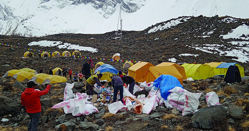
Popular peaks like Mt Everest and Manaslu get bad international press because of garbage piling up due to over-tourism. It is dangerous and expensive to bring down the trash for disposal.
There is now a solution to all these problems Nepal faces: drones.
First-person view (FPV) drones are changing the nature of warfare, as seen in Ukraine’s defence against Russian invasion and conflicts in West Asia. But like all technology, military hardware always has peacetime applications.
Unmanned aerial vehicles (UAV) are already proving to be a great leap forward in simplifying connectivity and providing cheaper solutions to a vast array of problems in Nepal.
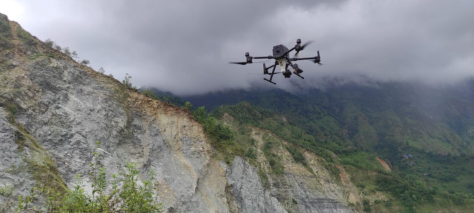
For example, when a massive debris flow on the Melamchi in June 2021 killed dozens and destroyed the headworks of Nepal’s most expensive infrastructure project, UAVs were used to assess the damage.
The Nepali non-profit Nepal Flying Labs could take high resolution images of the disaster zones even before relief teams could reach due to destroyed roads, cloud cover grounding helicopters and blocking out satellites.
Drones were also used to explore the upper reaches of the glacier-fed Melamchi and Pemdang rivulets to see where the flood originated. Similar drone footage helped locate the glacial lake overflows that unleashed the Thame flood last month.
Read also: The not-so-permanent frost, Wilfried Haeberli and Alton C Byers
Large scale deployment of UAVs in Nepal started after the April 2015 earthquake to assess damage, and in search and rescue in remote areas. Later, they proved invaluable to Kathmandu-based organisations like NSET (National Society for Earthquake Technology - Nepal) and International Centre for Integrated Mountain Development (ICIMOD) in planning reconstruction and relocation of damaged neighbourhoods. International media also used aerial shots of the destruction from drone cameras for their broadcasts.
In 2018, Mahabir Pun’s National Innovation Centre got the Robotics Club of Pulchok Engineering Campus to test drones to deliver medicines to remote areas, and this application saw some promise.
In one of many recent examples of Nepal’s laws being overtaken by technology, the government scrambled to formulate guidelines. And as usual, the response was to regulate and control rather than facilitate their legitimate use.
Officials worried about drones buzzing around heritage sites, near airports and over military areas. The Civil Aviation Authority of Nepal (CAAN) and the Ministry of Home Affairs cited security and privacy threats, as well as concerns about drone signals disturbing communication channels.
Within a month of the earthquake, strict rules were drawn up. Drone operators needed permissions from a slew of ministries, as well as the Army, and to follow strict rules like not landing near people and flying out of sight of the operator.
This did not stop drones being used, especially as the devices became small enough to be held in the palm. Rules were relaxed in 2019 and made more comprehensive in 2021. (See below) This allowed Nepali companies to launch drone operations: Nepal Flying Lab, Dronepal, Geovation Nepal, Madhukaa Drone Services, Airlift Technology, and others.
The companies offer various services, some of which overlap. All provide mapping and surveying options, such as high resolution images of municipalities, natural features like lakes and rivers, topo and contour mapping, and Digital Surface Models that precisely capture natural and man-made surface objects.
Dronepal and Airlift Technologies both specialise in 3D modelling, both of larger urban or mining sites and more detailed models of culturally important sites and monuments, like the Changu Narayan Temple.
Companies are able to turn drone images and footage into 3D models through softwares that stitch aerial images and videos. Drones can also be fitted with cameras that detect depth, or use LiDAR (Light Detection and Ranging) that bounces laser pulses off surfaces for detailed mapping.
“Most of our clients are construction companies, although there are some independent developers too,” says Milan Karki of Dronepal.
“There are a lot of hydropower companies. We can give them access to information about what kind of progress is happening on their projects through our models.”
Madhukaa Drone Services also provides surveying and inspection services as well as agricultural, delivery and rescue. Its drones can spray ‘nano-urea’ to fertilise maize fields. The company claims that this method is not only five times faster, but also reduces the amount of chemical seeping into groundwater.
Drones have also been used to plant seeds to help with reforestation after wildfires. Last month, the Ministry of Forests and Environment tested broadcast seeding of uttis (Nepali alder) from drones over the watershed to reduce landslides that wash down stone, gravel and sand into the lake (pictured, below).
TB airlift
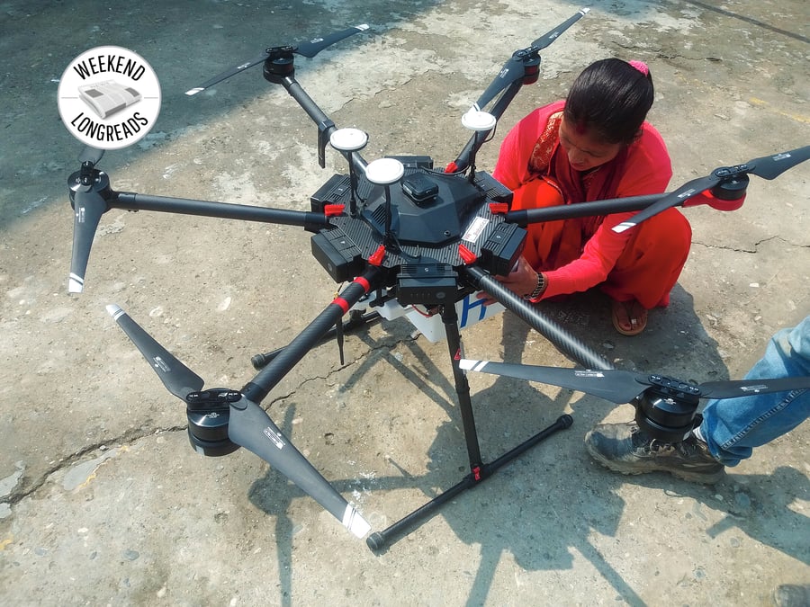
Drones have important applications in health. The Birat Nepal Medical Trust (BNMT) employed UAVs for an award-winning Drone Optimised Therapy System (DrOTS) experiment in 2019. It tested the collection of sputum samples, and treated patients infected with tuberculosis in the remote mountains of Piuthan district.
Funded by the Nick Simons Foundation, the drones carried the samples from remote homesteads in the mountains in bio-hazard safe containers (pictured, below) to Swargadwari District Hospital. The sputum was lab tested and patients who were positive were placed under the remote Directly Observed Treatment Short-course (DOTS) program that used smart pill boxes to keep track of if the medicine is being taken as prescribed.
DOTS was credited with reducing Nepal’s TB infection rate in the 1990s, but there were remote areas of the country still out of reach of the surveillance, diagnosis and treatment system.
“Getting the community to understand and trust in the project was very important to its success,” recalls Maxine Caws, principal investigator of BNMT’s IMPACT TB project that has been running for seven years. “People were quite proud that this new technology was being used where they live, and it even seemed to overcome their qualms about the stigma of being diagnosed with TB.”
The program ran out of funding, but showed great potential. BNMT is now working on reducing costs and finding new sources for grants.
The main hurdle for drone operators in Nepal now is not range anxiety, but to negotiate the bureaucratic maze for permits from 12 different government agencies – including five ministries and four local governments.
Caws adds, “Drones really seem to be optimal because they can zip between hills while health workers would have to walk long distances up and down to transport samples. That freed up their time to make an impact on the health of the locality in other ways.”
Influencer drones
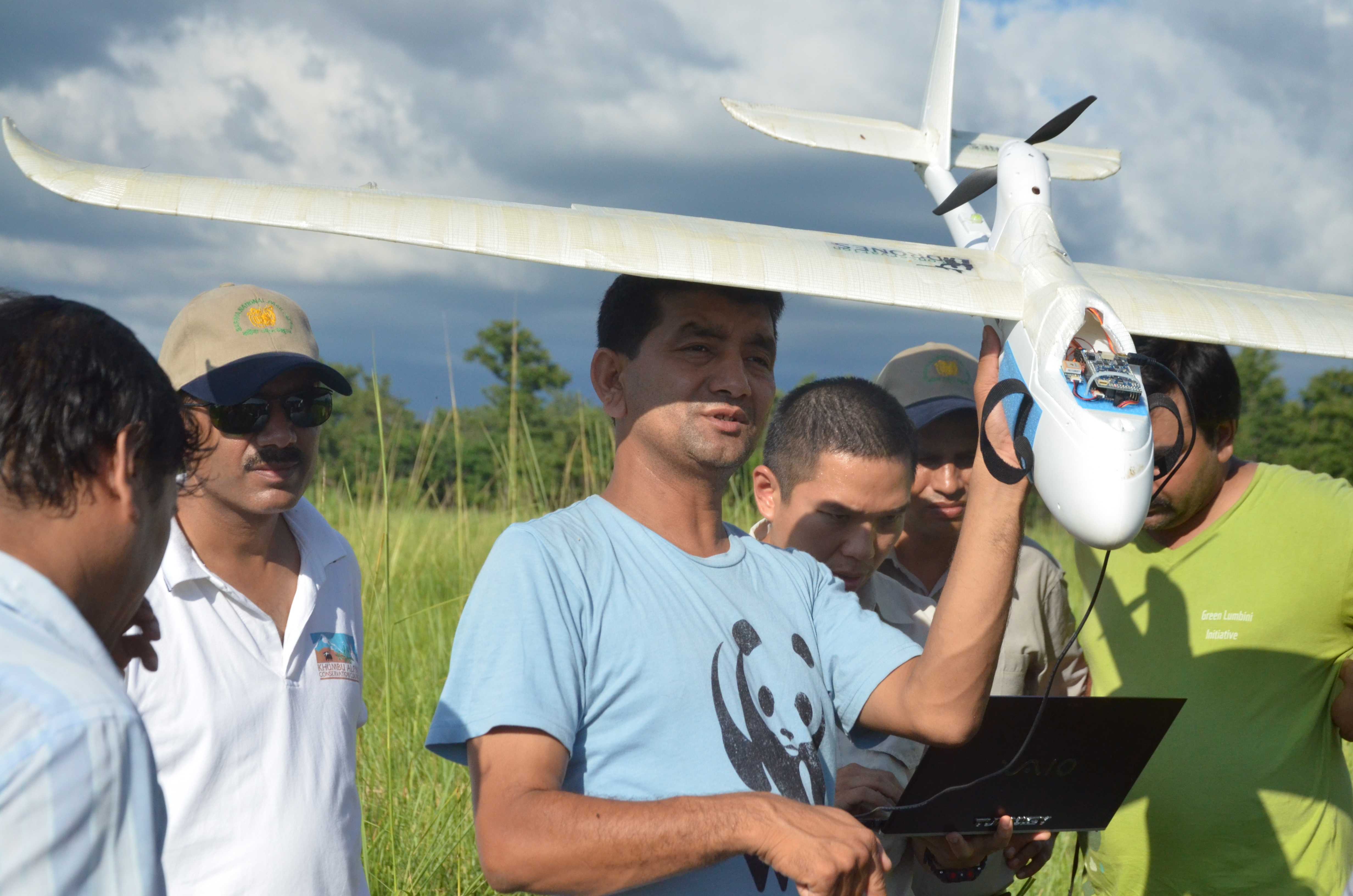
Drone filming by YouTubers, travel vloggers and influencers have been the single most important contribution to post-Covid revival of Nepal as a tourism destination.
Nepal’s mountains, river valleys, trekking trails, heritage sites and tropical national parks are ideal for drone filming. Footage of expeditions making their way up the Khumbu Icefall get millions of views around the world. Drones have also been used to promote Lumbini and provide an aerial view of Kenzo Tange’s plan for the Buddha’s birthplace.
But over-tourism along the Everest Trail and to a lesser extent other popular base camps like Manaslu and Annapurna have created a waste disposal crisis.
During the 2024 spring mountaineering season, Airlift Technologies collaborated with the local government to test Chinese drone company DJI's FlyCart 30 to haul trash to Base Camp. Heavier UAVs hold the potential to make it cheaper and safer to ferry garbage, and even bodies, from Nepal’s high mountains.
One of the advantages about the drone scene is that it is still a relatively new technology and new applications seem to be coming up all the time.
Worldwide, some of the more striking uses for drones include drone light shows, drone-based whale monitoring where UAVs are flown through mist exhaled by the giant mammals for non-invasive study, and volcano monitoring.
In Nepal, drones have already proved themselves in agriculture, nature conservation and health services. The future holds other potentials as more powerful drones with heavier lift capability, longer range, higher operating ceiling and ability to work together are developing in swarms.
Given the critical importance of transmission lines in evacuating Nepal’s hydropower, another potential application could be in laying, inspecting, and maintaining power lines in rural or hard to reach places, a technology already used in Canada and Norway.
WHAT ARE THE RULES?
The Nepal government is trying to play catch-up with rapidly evolving drone technology. As drones get bigger, more powerful and have longer range, or can fly in formations of hundreds at a time, new categories and rules are being made as we go along. Given the bureaucratic labyrinth and arbitrary enforcement by local officials, and as Nepali companies upgrade to the latest UAVs, it may actually be less of a hassle to just hire drones when here.
Before flying a drone in Nepal, operators must go through a lengthy, vague, confusing process that involves submitting a lot of documentation and obtaining many permission letters. The one official process is for applying with the Civil Aviation Authority of Nepal (CAAN) ‘Unmanned Aircraft System Requirements’ 2021 after which the ‘Unique Identification Number’ sticker must be attached to the drone.
1. A passport size colour photo of the applicant
2. Citizenship/Passport/Company Registration Certificate
3. Photograph of drone that shows its model and serial number.
4. Purpose of operation letter
5. Specifications of the drone, including the weight, the color, the payload type etc.
6. Copy of VAT bill if bought in Nepal, or Copy of Custom Clearance Certificate if imported
7. USD 10 + 13% VAT Registration fee
But that is just the beginning. Operators need a ‘Remote Pilot License’ from CAAN based on experience or equivalent certificates. And then permits from the District Administration Office, Ministry of Home Affairs, Department of Tourism, the Ministry of Communication and Information Technology, etc. Further permits are based on what the drone is being used for from the Department of National Parks and Wildlife Conservation--plus, just-in-case--letters from the Chief District Officer, the Nepal Police and Nepal Army.
Phew. The policy for getting caught flying an unauthorised drone is that CAAN can confiscate and auction the craft for revenue. But the fact that there are so many drones buzzing about trekking trails these days means people must have found ways to circumvent the rules.