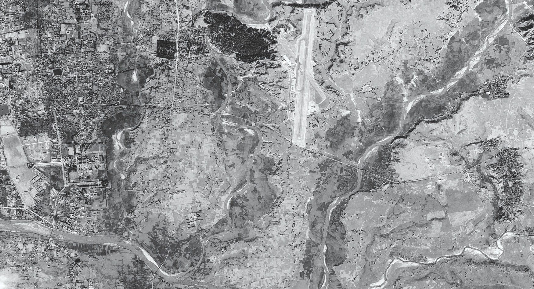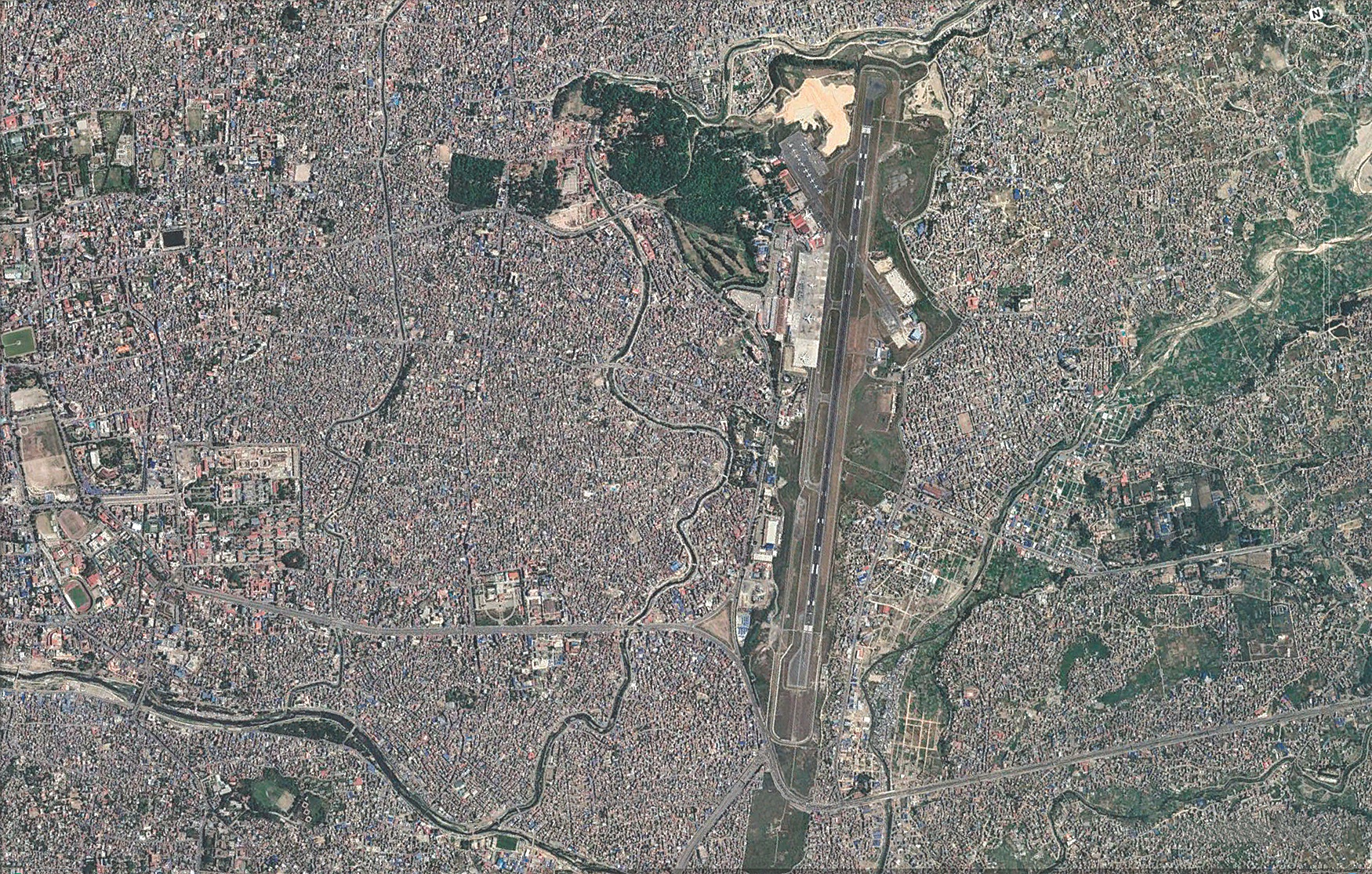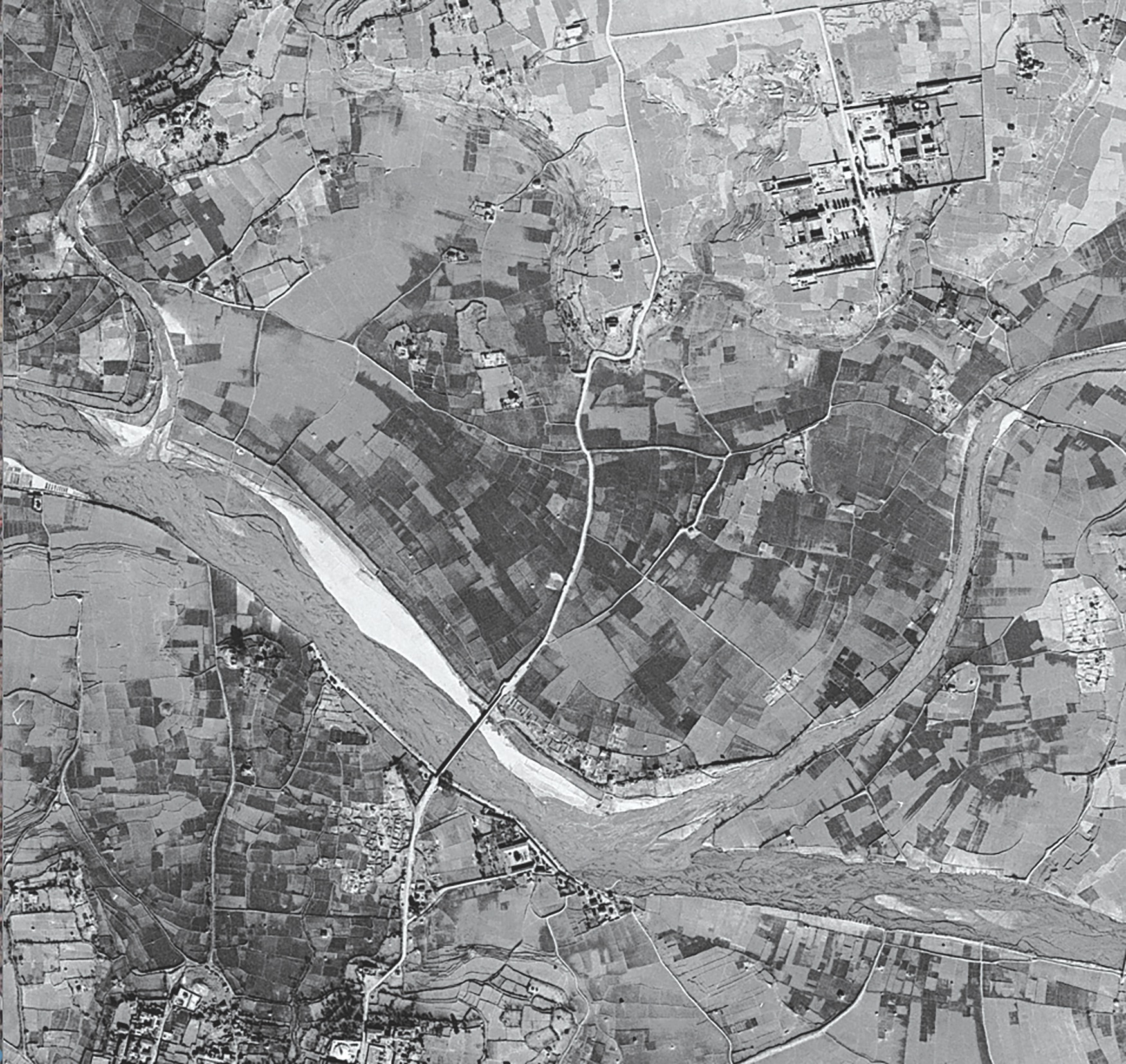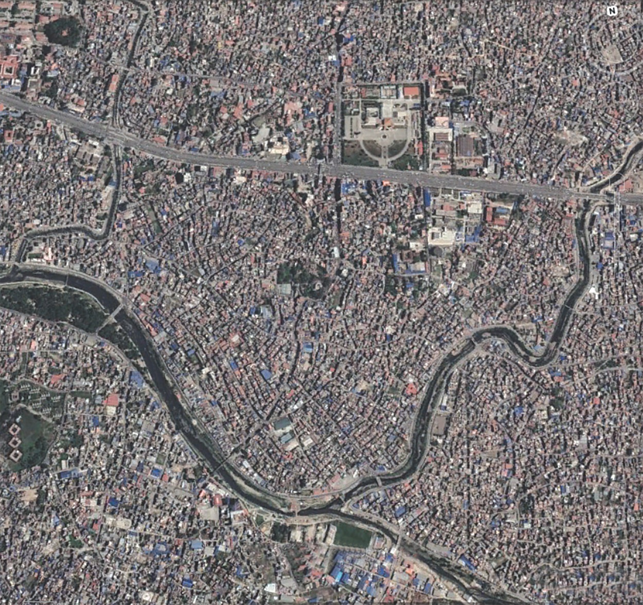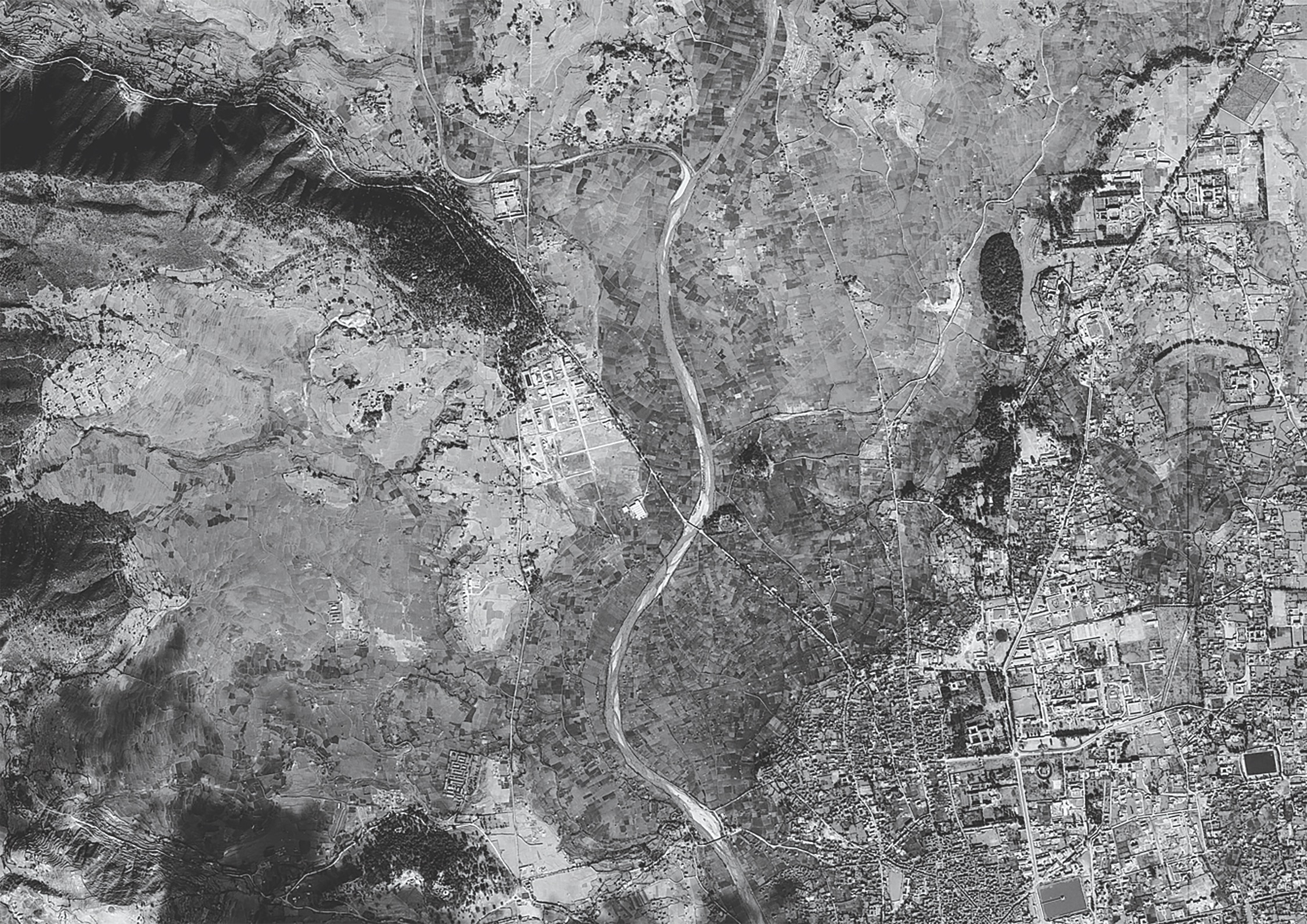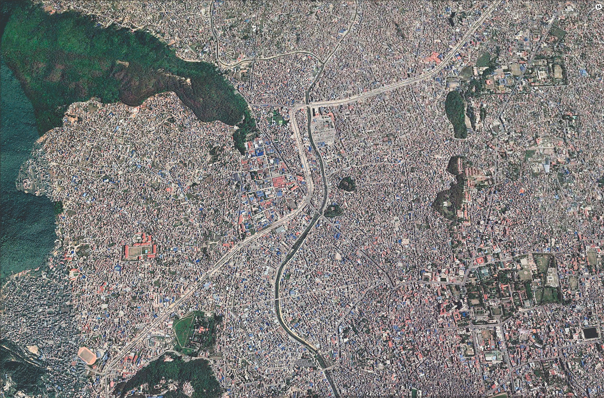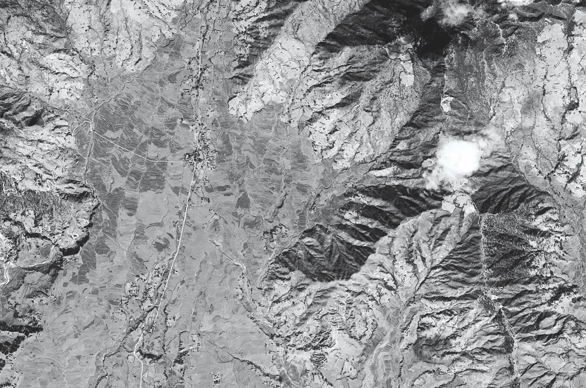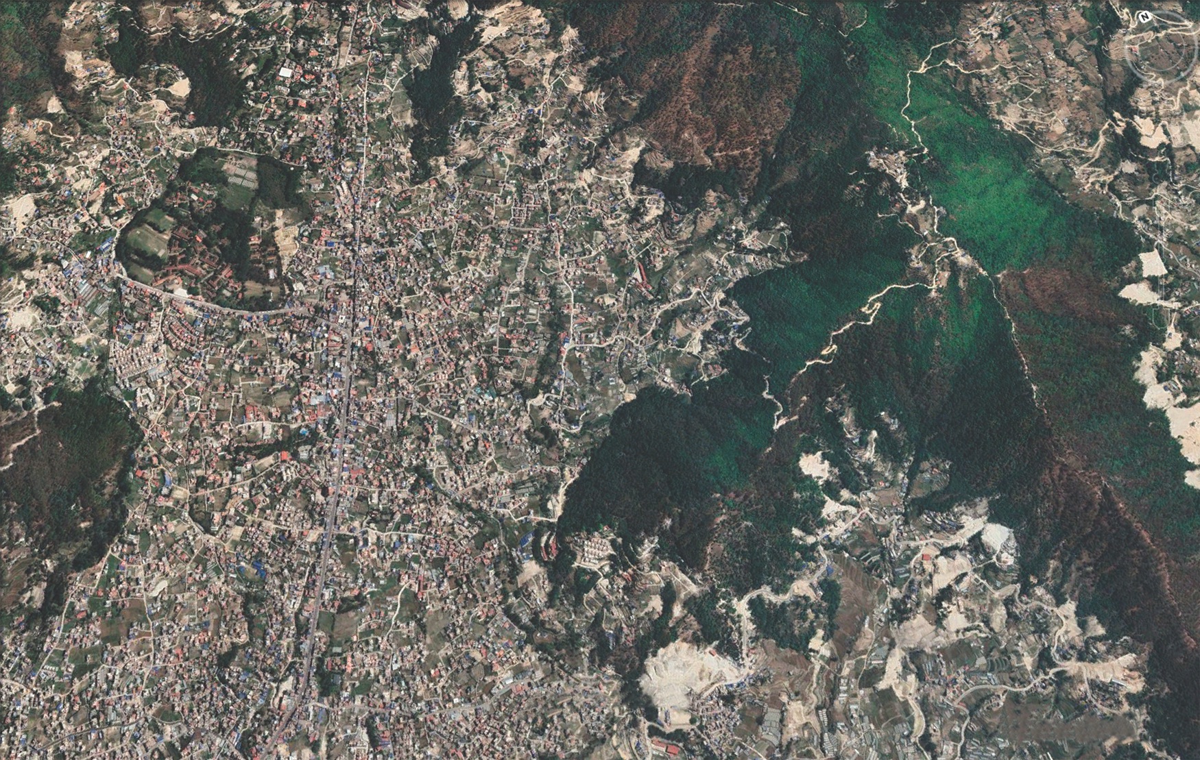
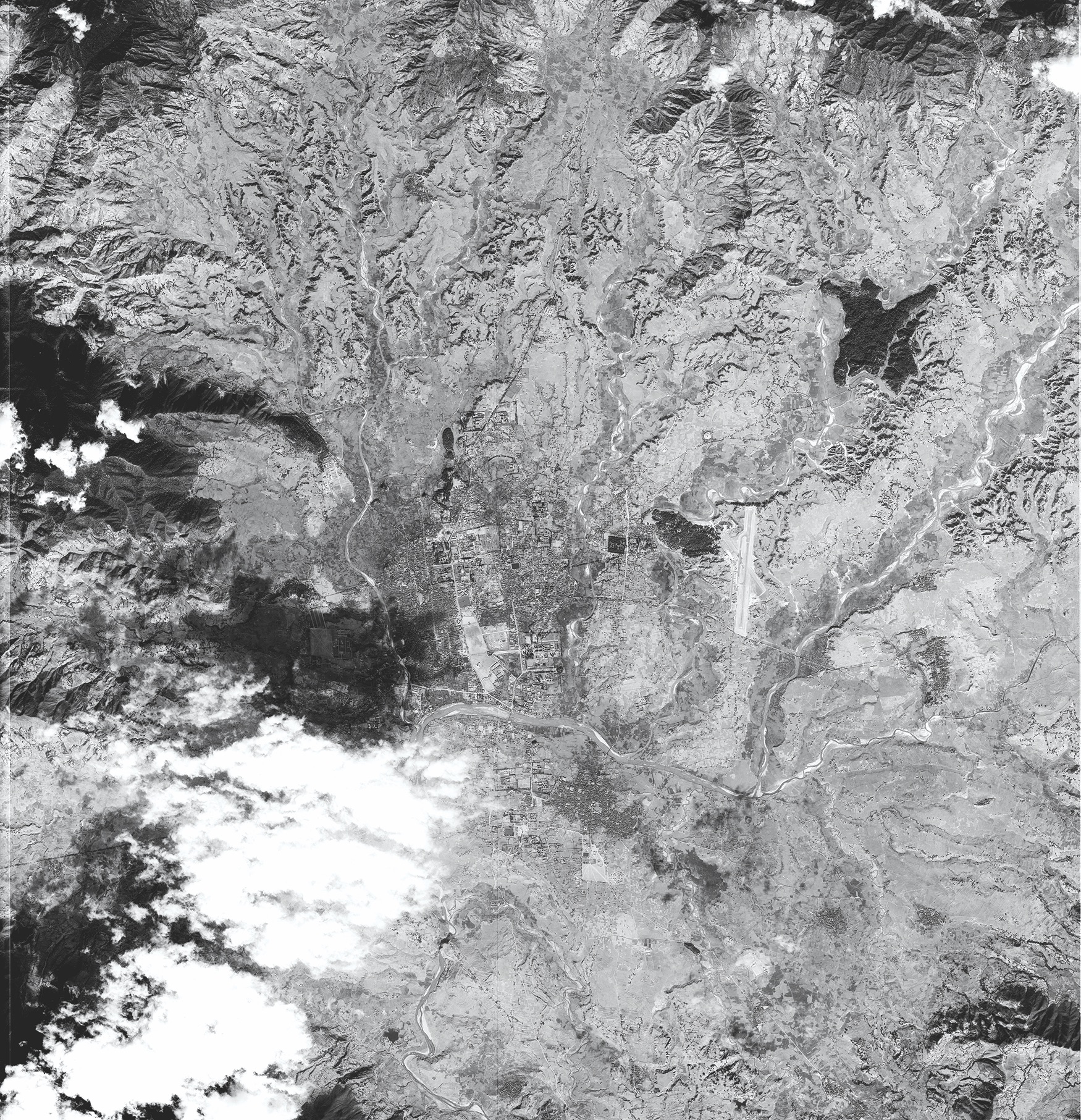
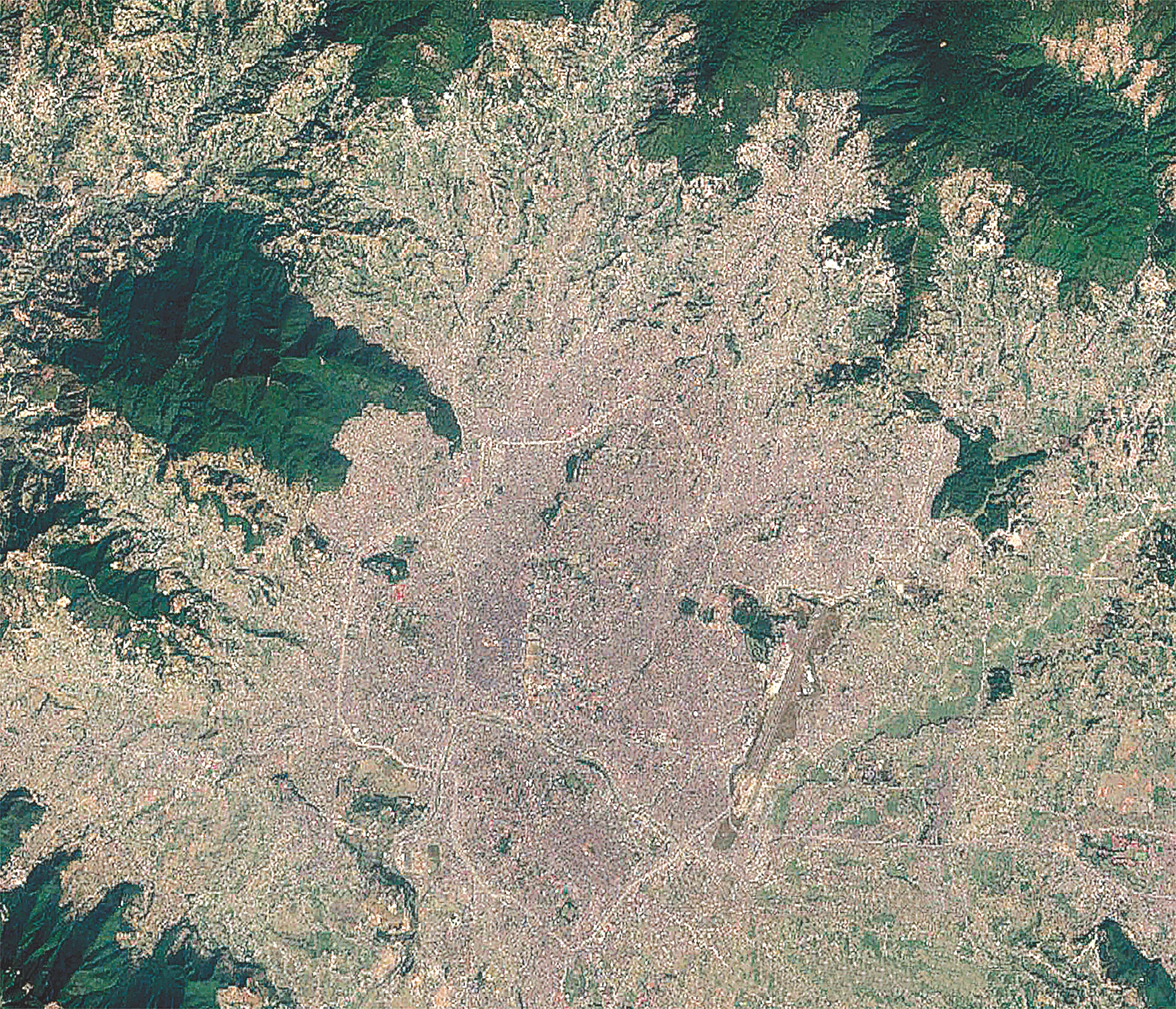
Then and Now: The Corona surveillance satellite image taken on 5 February 1967 shows the broad floodplains of the rivers flowing through Valley floor, Rana palaces, and the inner city of Patan and Kathmandu. The Google Earth Map taken on 20 April 2022, shows how much Kathmandu Valley has urbanised.
From ground level, residents of Kathmandu Valley know how crowded the city has become. Many remember the terrace rice fields before they were covered over by concrete terraces.
Now, this rampant and haphazard urbanisation is visible in satellite images thanks to the declassification of American spy satellite imagery from 60 years ago.
The Corona strategic surveillance satellites were launched by the CIA and the US Air Force between 1959-1972 to gather intelligence on the Soviet and Chinese ballistic missile and nuclear weapons programs.
This became especially important after an American U-2 spy plane was shot down over the Soviet Union in 1960. The Corona satellite is code named Keyhole and would snap pictures from 150km in orbit, and return a capsule to earth to be retrieved by special planes with hooks, and the film developed in the CIA darkrooms.
In all, 144 satellites were launched and many of them failed. But there are enough high resolution photographs of the earth’s surface. The images are now in the public domain after being declassified by President Clinton in 1992.
The images have been useful for anthropologists to study ancient aboriginal settlements in Australia, and uncover hidden Mesopotamian migration routes before they were obliterated by modern infrastructure.
Kathmandu Valley, obviously, has changed a lot. The Valley floor is now wall-to-wall buildings, the broad floodplains of the Vishnumati, Manahara and Bagmati are now choked with buildings, the Budanilkantha alluvial fan below Shivapuri, which used to be wrinkled with terrace farms are now built-up.