
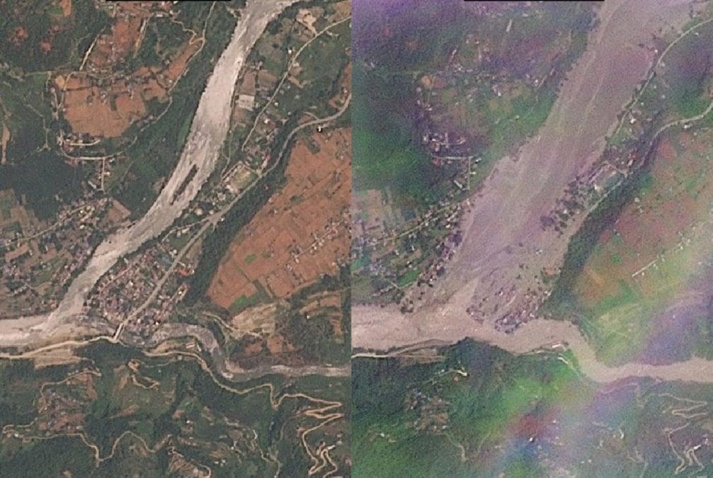
As tens of thousands of people in Nepal and China pick up the pieces after the catastrophic flood on 26 August, scientists are using remote sensing data to find the exact sequence of events that caused the disaster.
Most say there is a direct link to global warming, which is heating the Himalaya twice as fast as the global average. This has destabilised the ice cap on the already geologically fragile mountains in an active seismic zone.
Others admit that while climate change was a factor in this particular event, there appear to be underlying geological reasons for the slope failure.
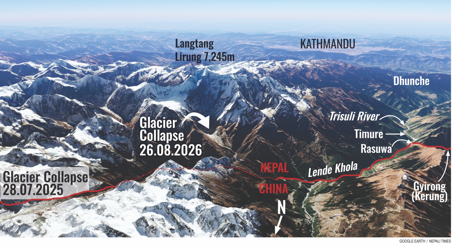
Latest satellite images of the flood's origin show a clean cleavage about 1.5km wide in a hanging glacier at 5,000m on the north face of Langtang Lirung (pictured). Some say this is not just the glacier calving but a bedrock failure, possibly because ice melt seeped into a pre-existing crack.
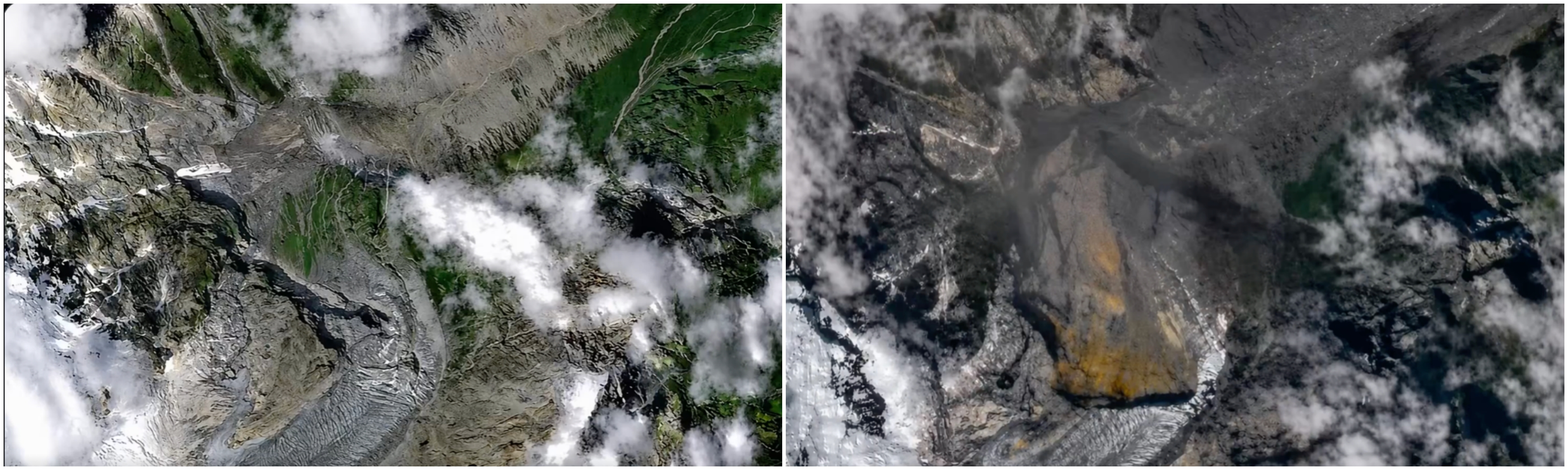
The bedrock fracture then sent the rock and ice tumbling down at least 1,000m onto the flatter glacier below. This kinetic energy from this movement and the resulting friction melted the ice. The mass was so massive that it triggered a local 5.2 magnitude tremor.
This mass melted as it fell and bulldozed the debris down to the Lhende Khola and another 15km down to the Rasuwagadi checkpoint on the Nepal-China border.
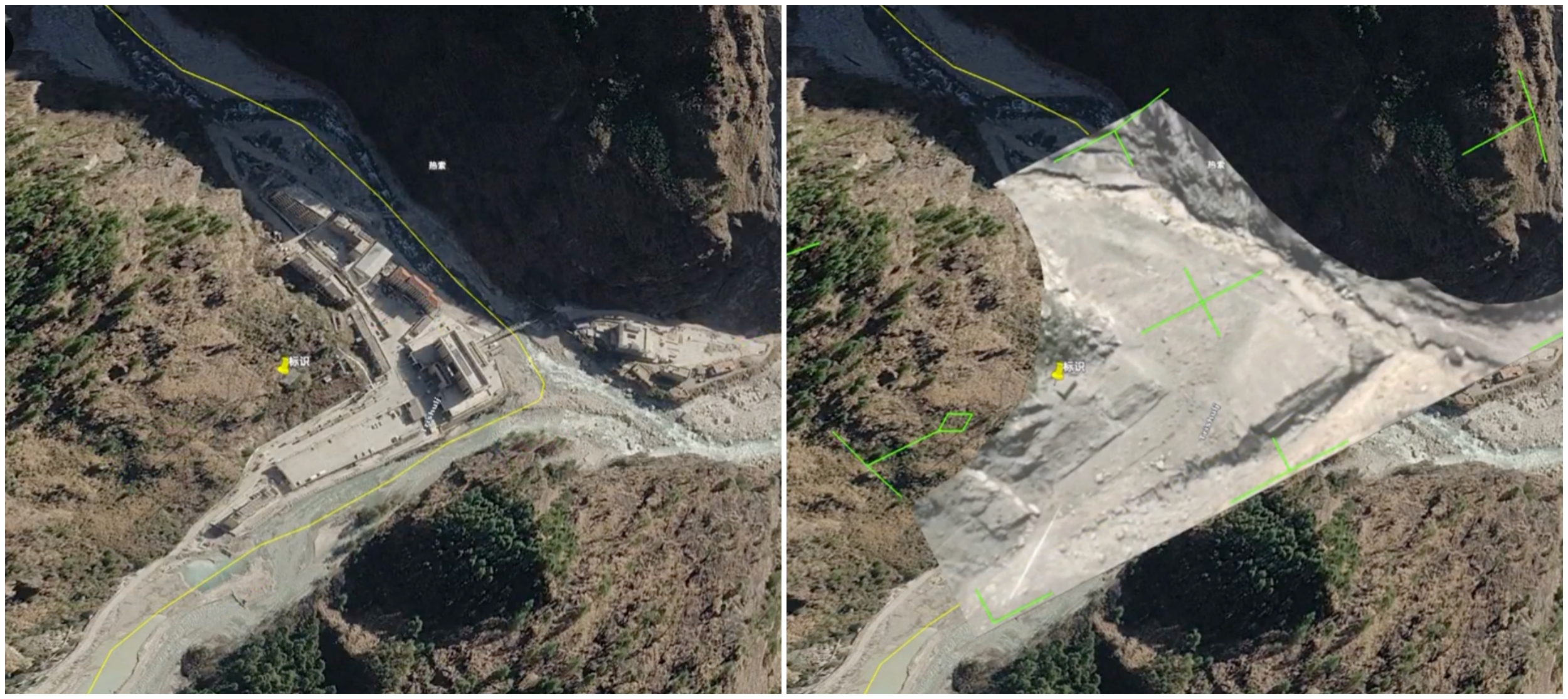
Scientists estimate that the rock-ice avalanche brought down up to 200 million cubic meters of debris, the largest such event geologists have ever recorded.
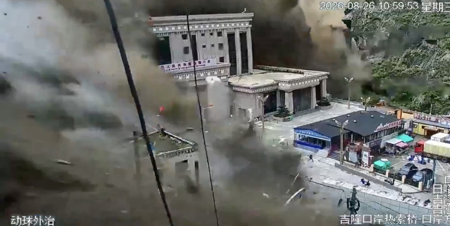
The now famous cctv clip of the 6-storey customs building on the Chinese side of the border shows how high and fast the debris flow came down the valley without warning, giving people there no chance to move to higher ground.
The debris flow on the Trisuli in Nepal was moving slower, and villagers were alerting people downstream on their phones, but many did not have a chance to flee.
Images of destroyed villages, power plants, bridges and roads downstream show scenes of utter devastation. So far at least 389 bodies have been recovered — some as far as 150km downstream near the Indian border — and at least 1,400 people are missing in Nepal and China. Meanwhile, 466 injured people have been rescued, say police.
Scientists say that although climate change was a factor in triggering the event on Langtang, there was a previous failure in the rock face itself below the ice. Fissures in the bedrock could have been loosened by melting permafrost, they reckon.
It is now established that this was not a glacial lake outburst flood caused by climate change. And that risk still remains with more than 50 potentially dangerous expanding glacial lakes in China and Nepal that still pose a threat.
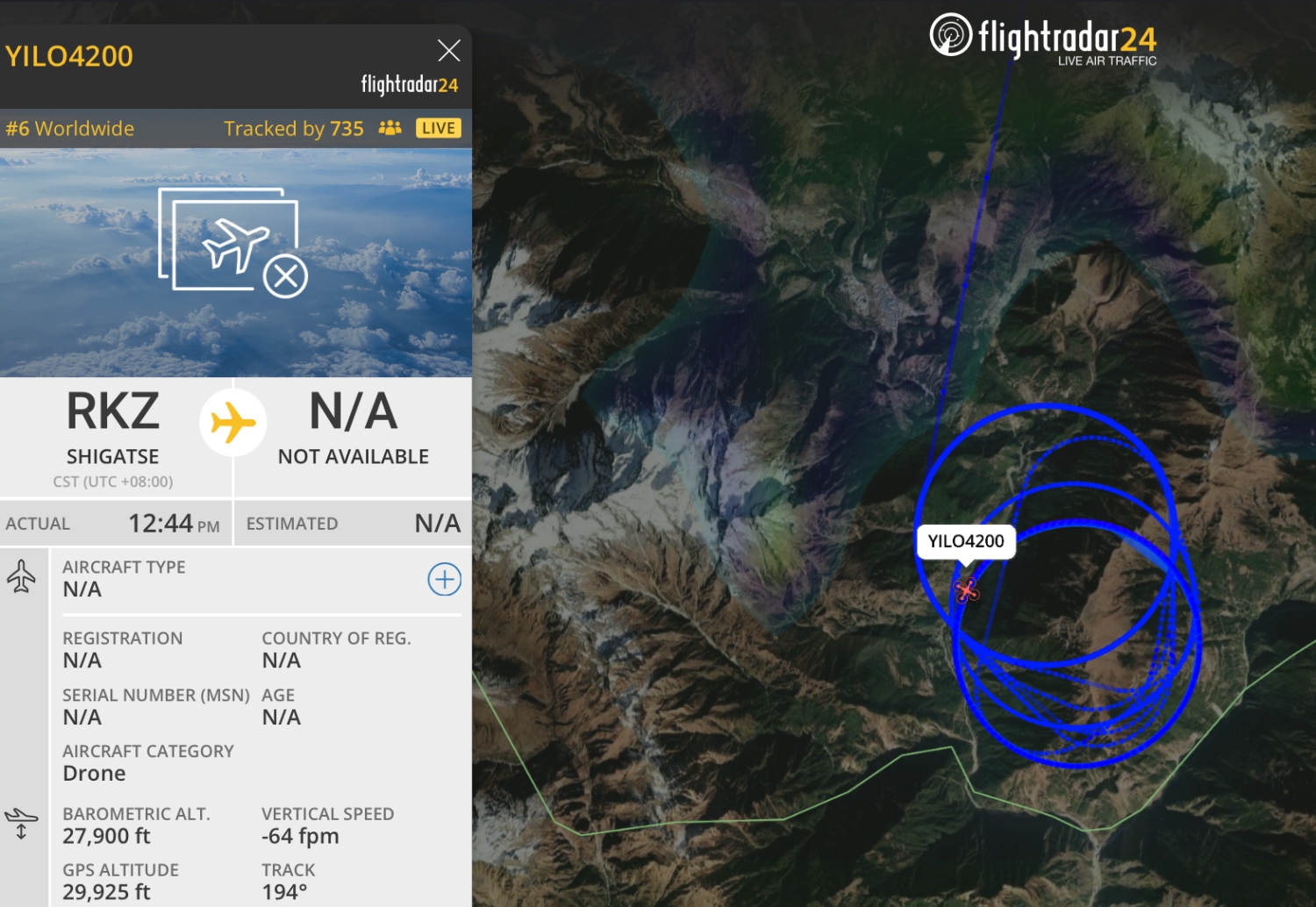
Chinese drone inspections of the avalanche site show that a lake has formed along the Lhende Khola after being impounded by the falling debris, and this still poses a danger to the downstream areas.
If you are looking to support communities affected by the flood in Nepal, donate to the Prime Minister's Disaster Relief Fund here. Additional information here.