
The army man ran full pelt, flailing his arms, shouting. Seconds later he reappeared on the far side of the field, in the wake of a galloping white horse. Travellers gathered behind us, impatient to be on their way. When the man returned, panting, he had to restrain a dog from trotting into the blast zone. “Hyaaa let that good-for-nothing die!” muttered an older man, just before two sharp explosions plumed up from the forested ridge obscuring the new road. A hundred metres away an excavator brushed rocks away in a constant clatter. It was just another day on the Annapurna Circuit.
The 18-day classic around the Annapurna massif is fading into history. Trekkers still lug their packs over the 5400m Thorung-La, but their numbers are much diminished. Tourism entrepreneurs are no longer able to ignore the impact of the ragged scratch of a road the Nepal Army has blasted up on either side of the horseshoe circuit. With other trails opening up across the country (notably, the Manaslu Circuit next door), there’s no doubt the region’s crown jewel of a trek has lost its lustre.
Manang district’s first pilot, Tripple P Gurung (see box), has spent years talking to the villagers about the need to adapt to the new ground realities. Last June, with some support from the Annapurna Conservation Area Project, he led a survey of potential routes in the eastern reaches of the Annapurna Circuit.
“It’s like this, buwa,” he tells the elders of the settlements we pass through. “The road is here, whether you like it or not. There will be less people doing the 18-day circuit. But there are different kinds of tourists, so you have to be open to the idea of promoting different kinds of treks. Some of these will even be made possible by the road.”
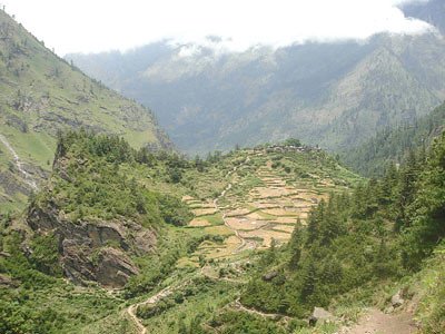
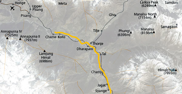
From Taal, the first village in Manang district, our amateur survey was to follow a ‘hunter’s trail’ to Naiche (see map). The route was meant to be difficult but passable and was described to us as a viable alternative with a great many approving nods by a council of villagers. But two days of teetering up and down grassy cliffs behind our local guide, many a nettling scratch and tingling nerve later, we could still espy the rusty tin roofs of Taal along the Marsyangdi River.
It was a disappointing payback for our efforts. Water was scarce, the paths were ill defined, and there was nothing to see that you couldn’t see from the riverine route (and future road) to Naiche – which would have taken five hours instead of the fifteen for our detour.
Naiche’s charm and chicken curry soothed our tired limbs as, once more, we gathered the villagers round. This time, we were to veer right off the Annapurna Circuit, visit Duna Lake, then cross a pass down to Guo to join the last leg of the Manaslu Circuit. The villagers delighted in having us laboriously copy out Gurung place names in lieu of the Nepali-language variants forced upon their landmarks and the next morning we split into two groups.
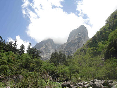
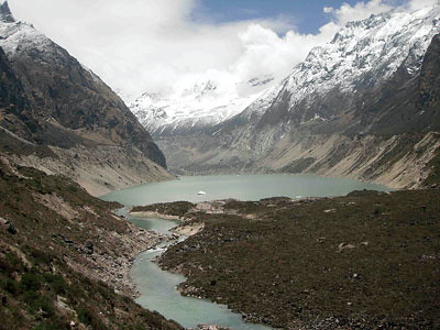
The ‘easier’ route was a long slog up to Krom (Alubari) and down again; the lower route cut through thick subtropical jungle, with a few very rickety ladders and steep scrambles thrown into the mix. Reunited late in the day, we overnighted in a cave and pushed on through pine forests and late summer blooms to turquoise Duna Lake. Then we backtracked towards camp below Kyampu Danda. My first sight of an impeyan pheasant – a splash of a rainbow against the forbidding alpine terrain – made up for the exhausting trudge in the evening drizzle.
Surveying the monsoon-smudged panorama from the top of the 4400m pass the next morning, we felt, palpably, the potential of linking up the Annapurna and Manaslu circuits. All we had to do was heave ourselves down to Guo, down by the Dudh Khola. The only problem was no one had crossed from Naiche to Guo in at least 150 years.
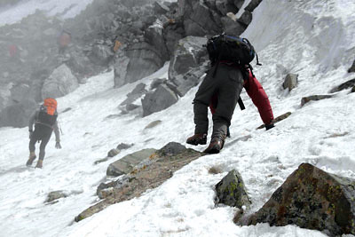
Despite the best efforts of our guide, we got hopelessly lost. Stumbling from ravine to gnat-infested jungle to ice-frosted trails and back again, it took us nearly 10 hours to descend two kilometres. When we finally got to Guo and gasped out where we’d come from, a hotel owner cracked a gold-toothed smile and accused us of pulling her leg: “Dhaateko?”
The final leg of our survey, from the wonderfully picturesque village of Taiche, was a three-day hike through the badlands below Kangaru Himal (6981m), to the east of two villages recently incorporated into the tourist trail, Nar and Phu. We pushed vertically up from Taiche, through forests running with streams and dappled with wild strawberries, and into the shadows of gigantic grey monoliths. Past yaks and horses seemingly abandoned for the duration of the grazing season, we then moved up through misty mountains to a 4900m pass, skittering over rock and ice to finally behold the burnt sienna of Namkye Bhanjyang, frequented exclusively by yarsagumba pickers.
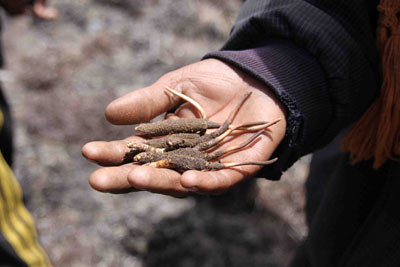
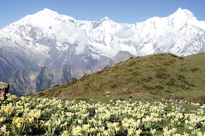
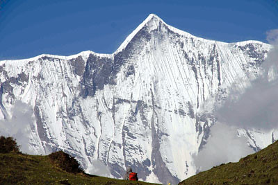
Orange and blue tarps dotted the lower reaches of the plateau and soon we encountered yarsa pickers scouring the earth for the caterpillar fungus so beloved of Chinese medicine. We braved another pass – where two members of our party slid off the trail onto the snow before coming to rest short of an abyss – and eventually arrived at a mist-drenched temporary settlement where scores of pickers huddled around fireplaces dispensing burnt yak meat and raksi. It was the perfect setting for the next morning’s crystal clear vista reaching from Lamjung Himal (6932m) to Annapurna III (7555m). Our survey concluded with a long descent to Meta, where we joined the Annapurna Circuit at Koto.
It was a quick walk back to Chyamche and a jeep, stopping only to observe the damage wrought by a landslide close to Taal. The road was here, but it wouldn’t be fully functional for a good many years, even if it was already affecting the entire region.
“If you really want to know if locals want the road, you’ll have to interview everyone in the village,” young Dudh Jung Gurung declared to us en route.
Whatever one’s opinion, it seemed clear at least that the demise of the Annapurna Circuit wasn’t synonymous with the demise of trekking tourism. Rather, it could be seen as launching pad for a more variegated tourist industry. As we dusted down our weary limbs and packed away our GPS units, we hoped that the paths we’d trodden would one day graduate into trails of discovery for those seeking more than a ‘reboot’ of the beaten track. Wild Nepal lives on, just not where we’ve grown accustomed to finding it.
Nature’s bounty

Blazing trails
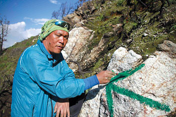
The fact that locals walk from A to B doesn’t mean the world can follow. Our survey team deployed GPS (Global Positioning System) units to map out the routes walked, noted where trail improvement would be needed, and used its collective experience to gauge the suitability of the routes for future hikers in terms of difficulty, camping spots, and water sources as well as natural and cultural highlights.
The good news is Gurung has secured funding from the Trekking Agencies’ Association of Nepal for a professional survey of the route this April. The expedition will confirm the viability of trails to Duna Lake (the ‘rhododendron trail’) and through Namkye Bhanjyang (the ‘yarsagumba trail’).