
Alton C Byers and Lhakpa Sonam Sherpa have teamed up to expand, update, and improve the first edition of Khumbu Since 1950 published in 2017. The result is a first-rate photographic documentation of the dramatic changes which have occurred in the villages, forests, and glaciers of the Mt Everest region over the past 73 years.
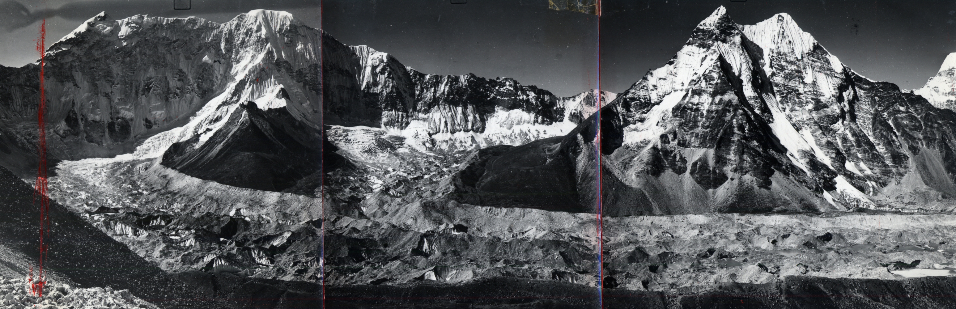
Both the historic and recent photo replicates are of excellent quality, and even the more than 70-year-old enlargements acquired from contact prints of 35-mm negatives appear remarkably clear (it was necessary to use the prints of the negatives because the negatives themselves had been lost).
Their own replicas of the historic photographs are outstanding, especially considering that taking them required many hundreds of kilometers of trekking, and thousands of meters of climbing, even some serious semi-technical mountaineering, in search of the exact locations from which the historic photographs had been taken, as far back as 1950 and the first visits by westerners to Khumbu.
The photographs have been expanded from the original 133 to 228, many of them never before published and taken by the first western climbers, climber-scientists, anthropologists, and development workers to have visited the region (the lack of historic photographs taken by Sherpas reflects the lack of personal cameras at the time).
The resultant collection, many of them panoramas originally taken by photogrammetric cameras in the 1950s, covers the fields of anthropology, human and physical geography, landscape change, climate change, and glaciology.
This leads to assessments of the impacts of the massive increase in trekking tourism and mountaineering since the early 1970s, together with the effects of current climate warming. It follows that the photographic collection is of vital importance as a historical document, and in the words of Lhakpa Norbu Sherpa “…could very well serve as the foundation for future monitoring, and subsequent management, of the Sagarmatha National Park and Buffer Zone’s changing cultural and physical landscapes”.
Byers and Sherpa introduce us to many of the early pioneers of mountaineering, survey, and conservation in the Khumbu. They include John Hunt, Charles Evans, Fritz Müller, Erwin Schneider, Helmut Heuberger, C. von Fürer Haimendorf, Charles Houston, Bruce Jeffries, and Nick Ledgard.
The book includes a foreword by the late Venerable Ngawang Tenzing Zangpo Rinpoche, Abbot of Tengboche Monastery, who reminds us of “…how quickly our culture and landscapes can change, and thus the importance of balancing this change with adequate protection of all living things.”
The preface by Byers describes the evolution of the book, from his first visit to Khumbu as an undergraduate student in geography in 1973 to his more recent work documenting the impacts of climate change, especially the danger of glacial lake outburst floods (GLOFs).
Lhakpa Sonam Sherpa tells the story of how, in spite of losing his hearing to meningitis at the age of 19, he has overcome the resultant challenges to become one of Nepal’s foremost landscape photographers, the founder of the new Sherpa Culture Museum in Namche Bazaar, and the recent recipient of a prestigious award for his lifetime achievements from the Government of Nepal.
A new chapter, Introduction to the Sagarmatha National Park and Buffer Zone, Khumbu, Nepal: Past Present, and Future introduces the reader to an updated account of the people, history, vegetation, and glaciers of the region, written from the perspectives of one author who has studied the region for over 50 years, and the other who was born there.
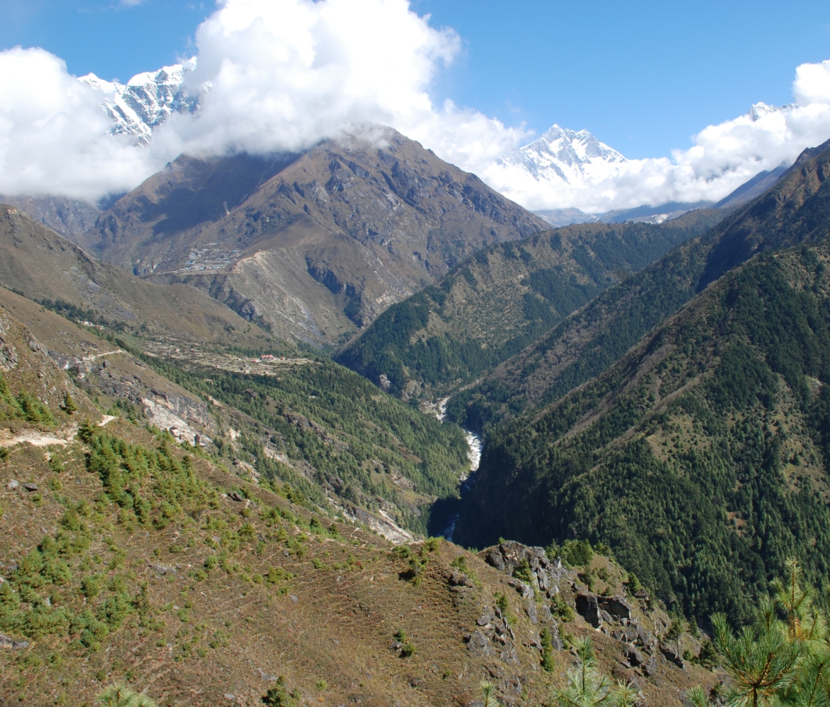
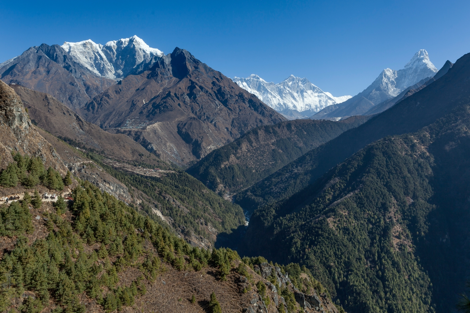
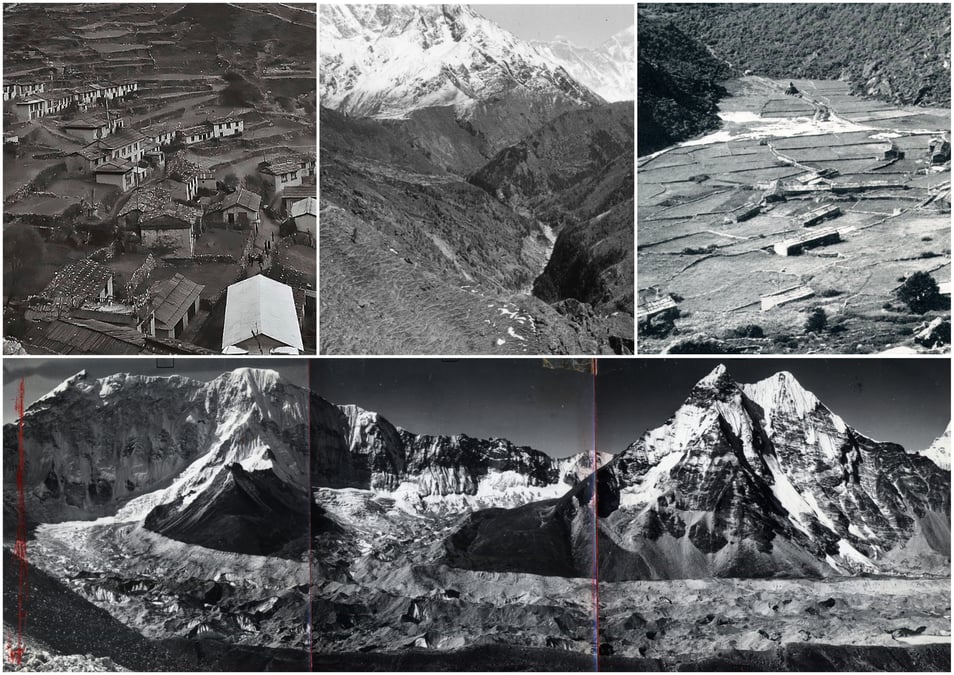
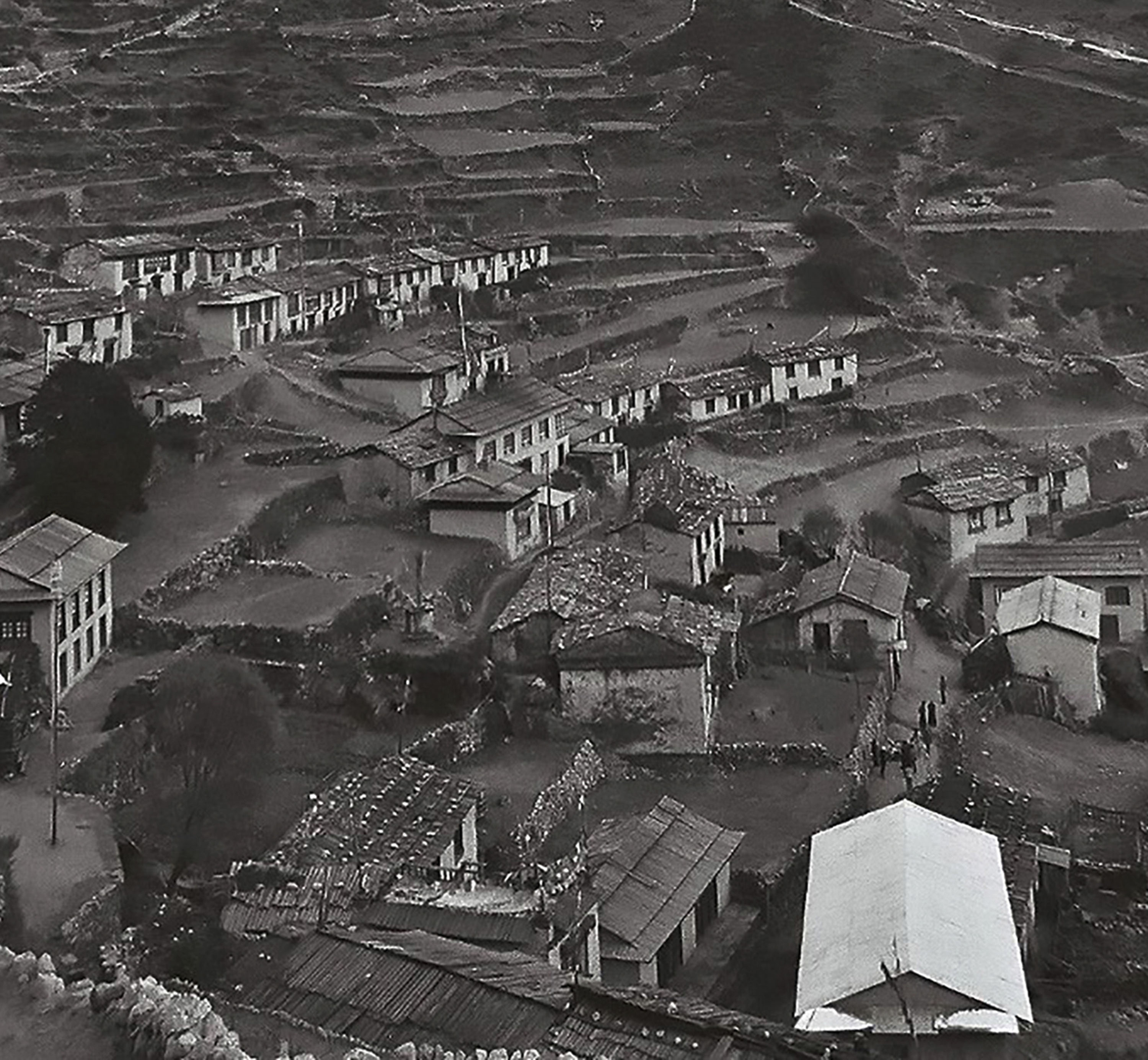
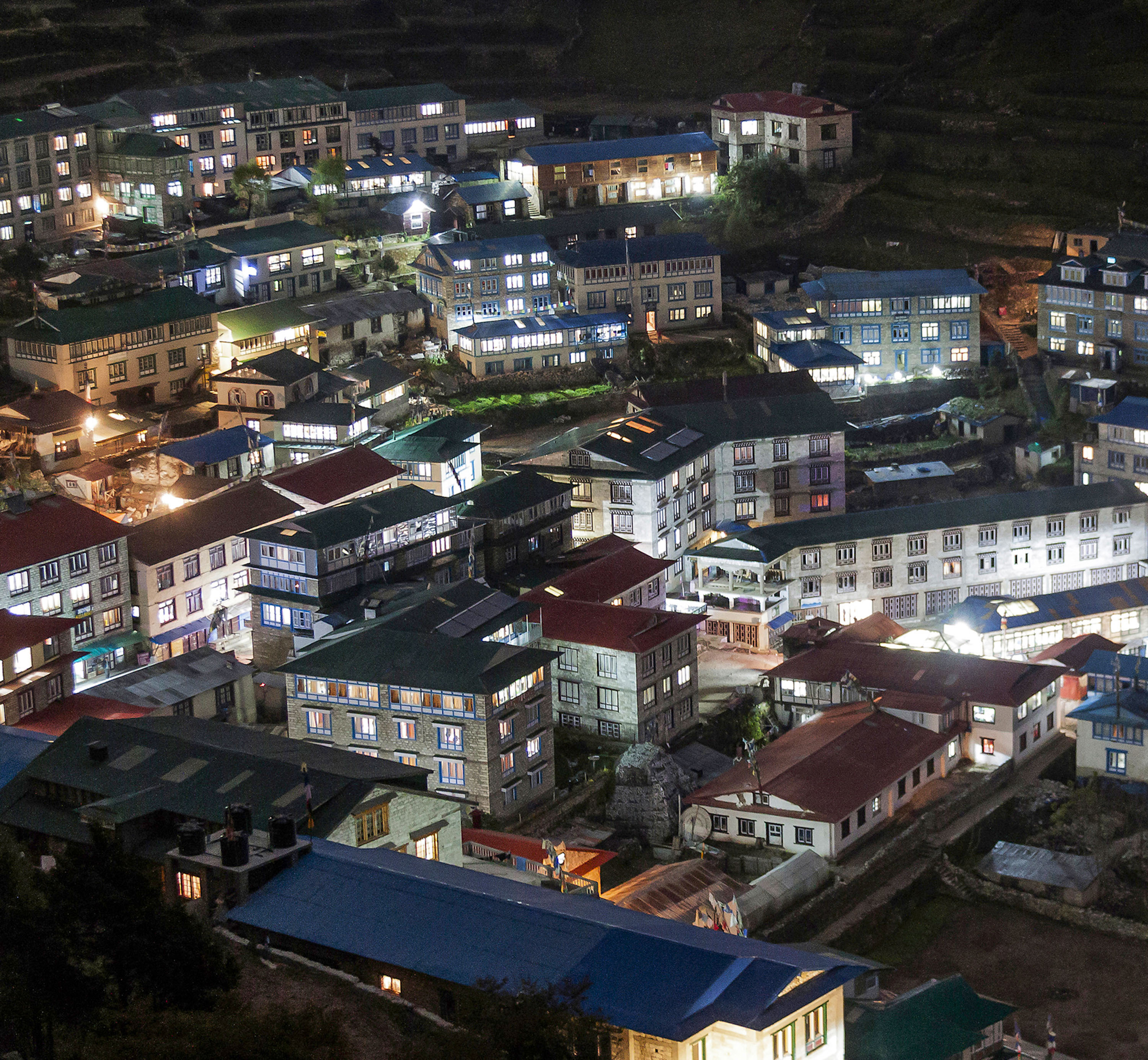
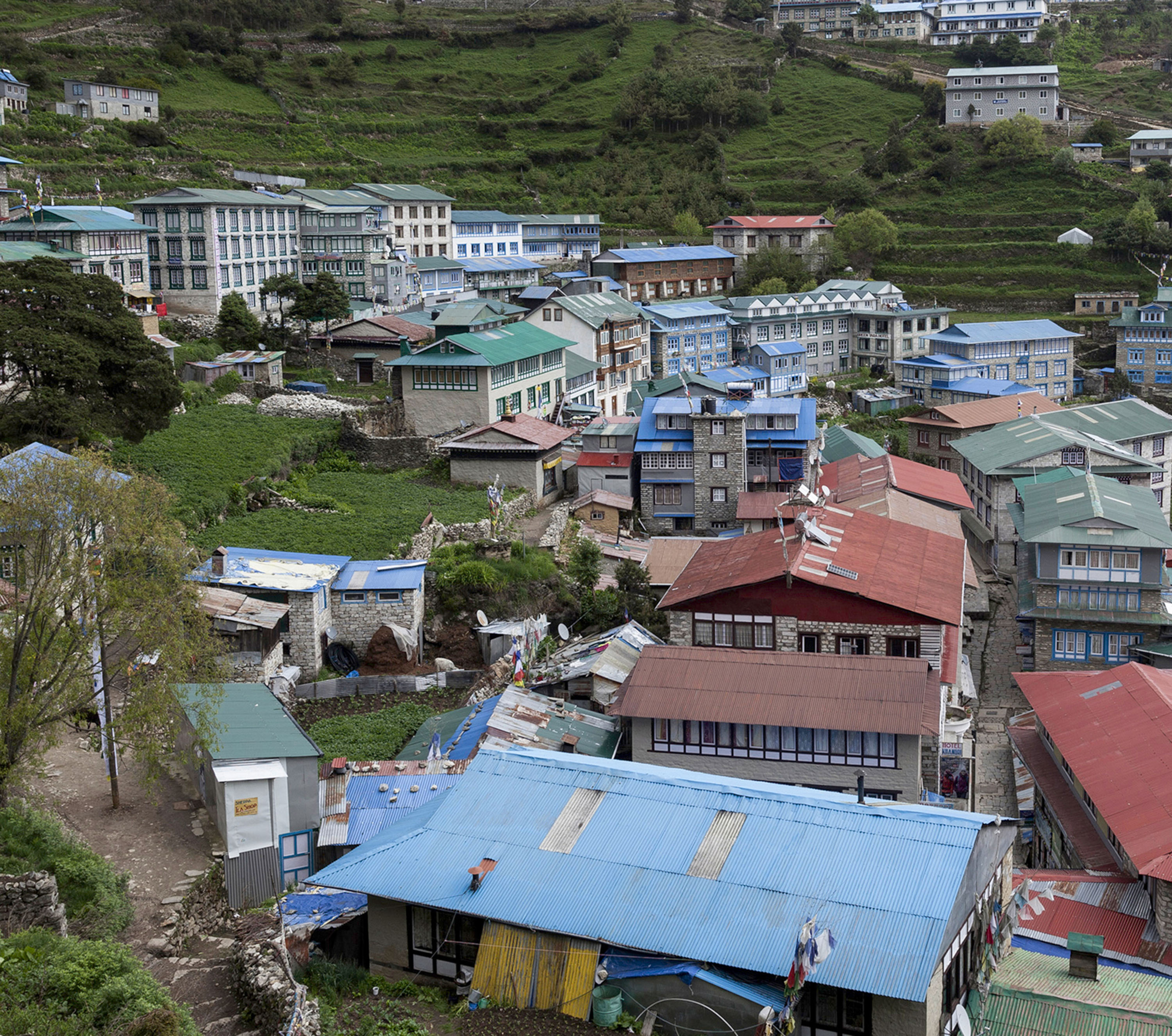
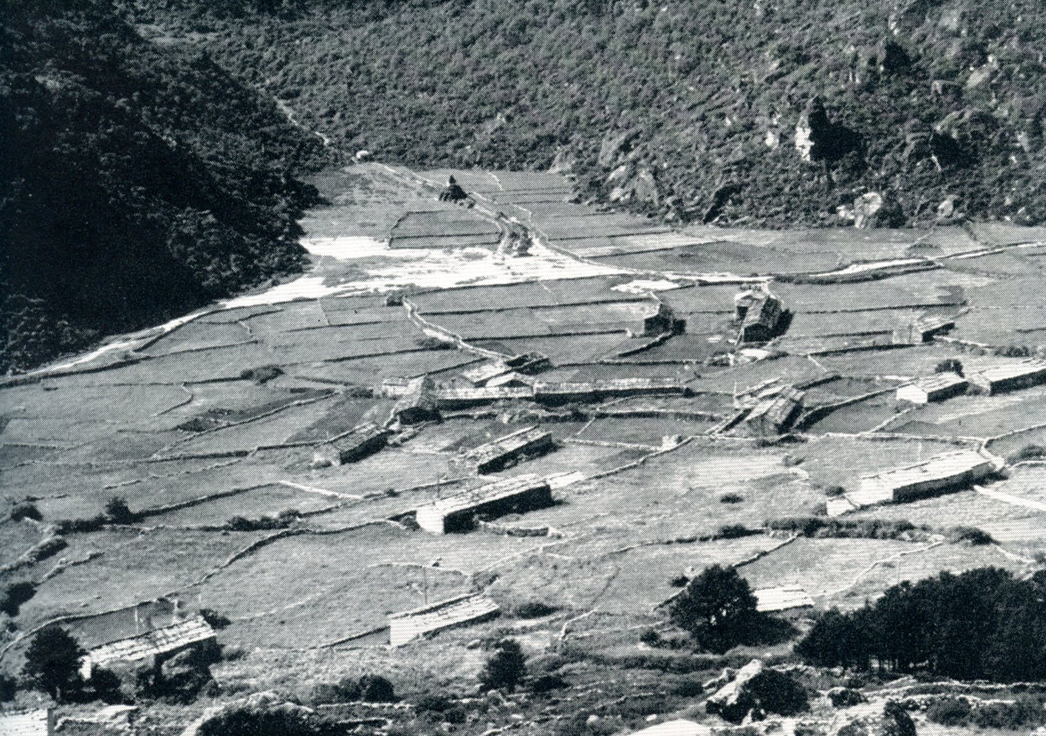
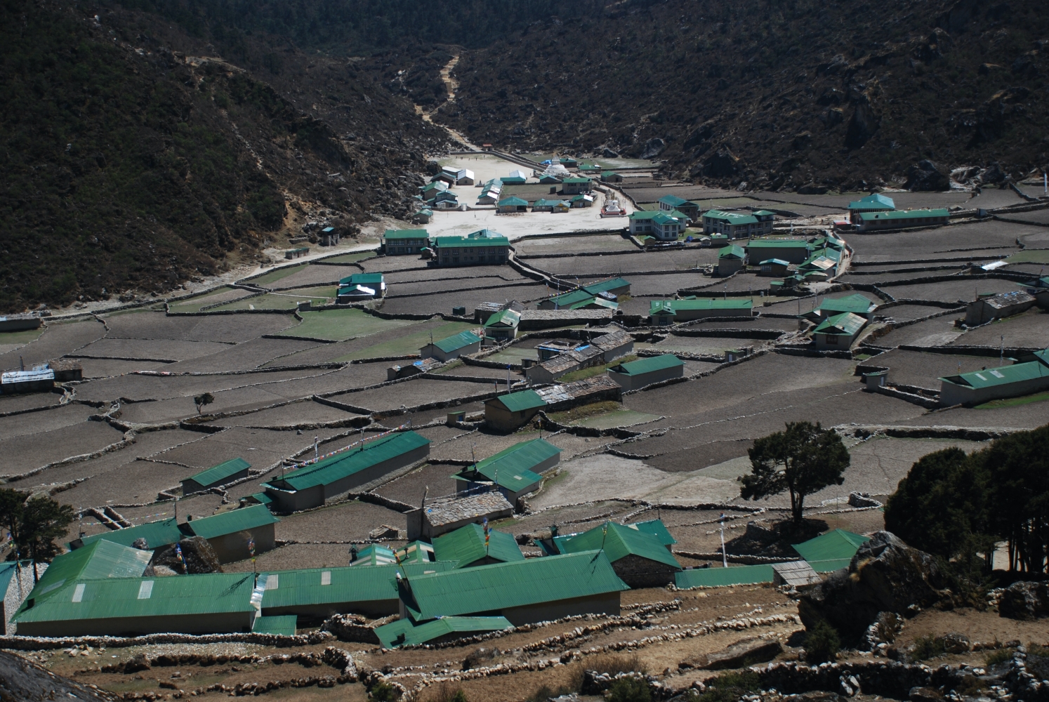
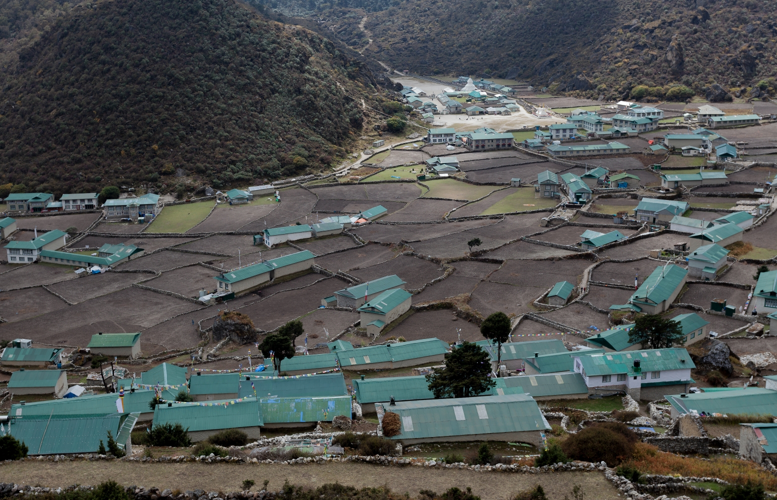
The book then leads us on a tour of the Khumbu region over time, from Junbesi in 1954, to the Lukla airstrip, to Chermading, Phakding, Namche, Tengboche, Dingboche, to the far reaches of the Imja, Gokyo, and Thame valleys. Dramatic changes in villages, from sleepy traditional communities to bustling international tourist centers, are illustrated in dozens of repeat photographs.
The rapid regeneration of Khumbu’s subalpine forests over the past 50 years is clearly evident in a number of different photo pairs, and challenge the hypotheses of ‘deforestation in the Khumbu’ so popular with developers in the 1970s and 1980s.
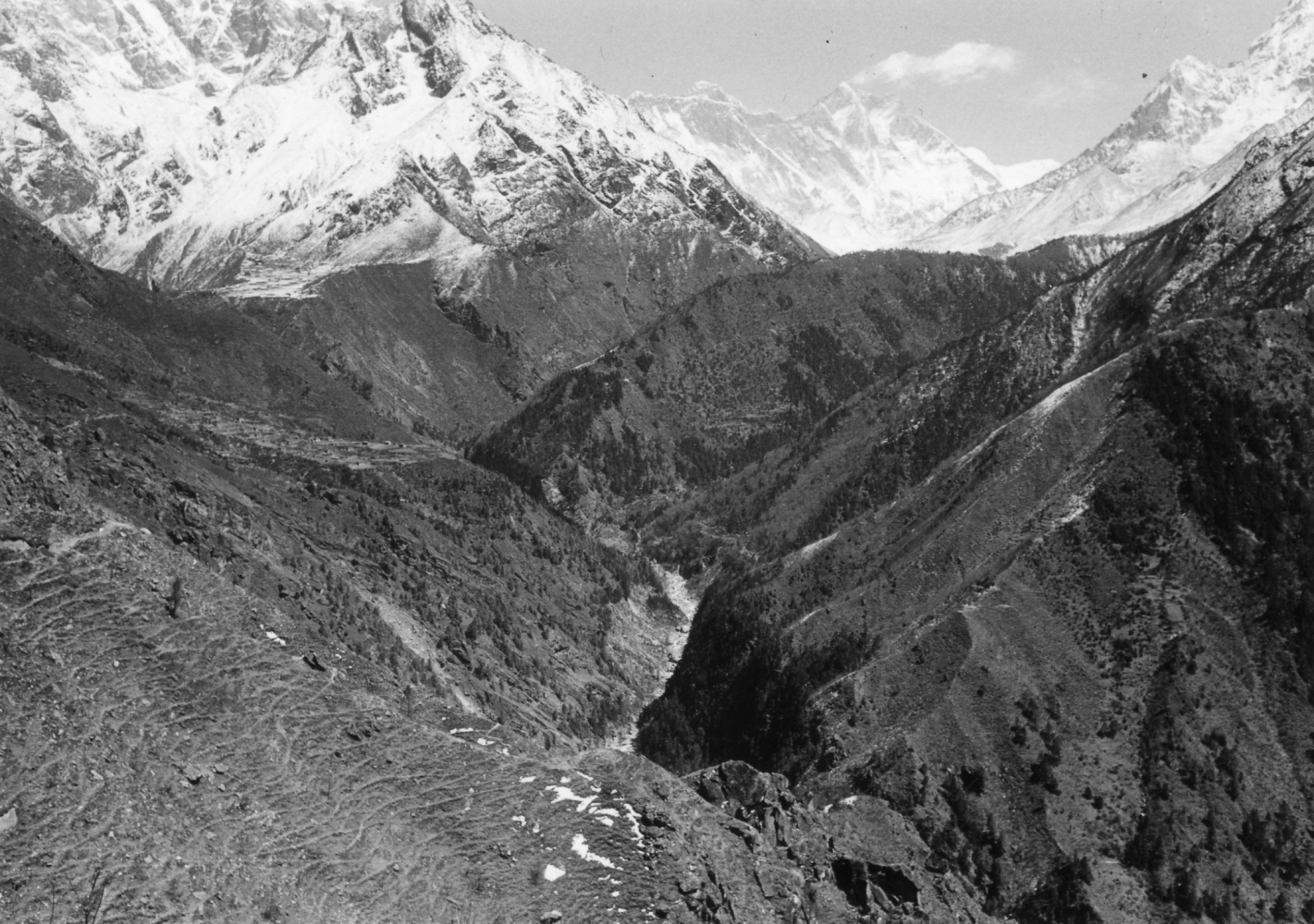
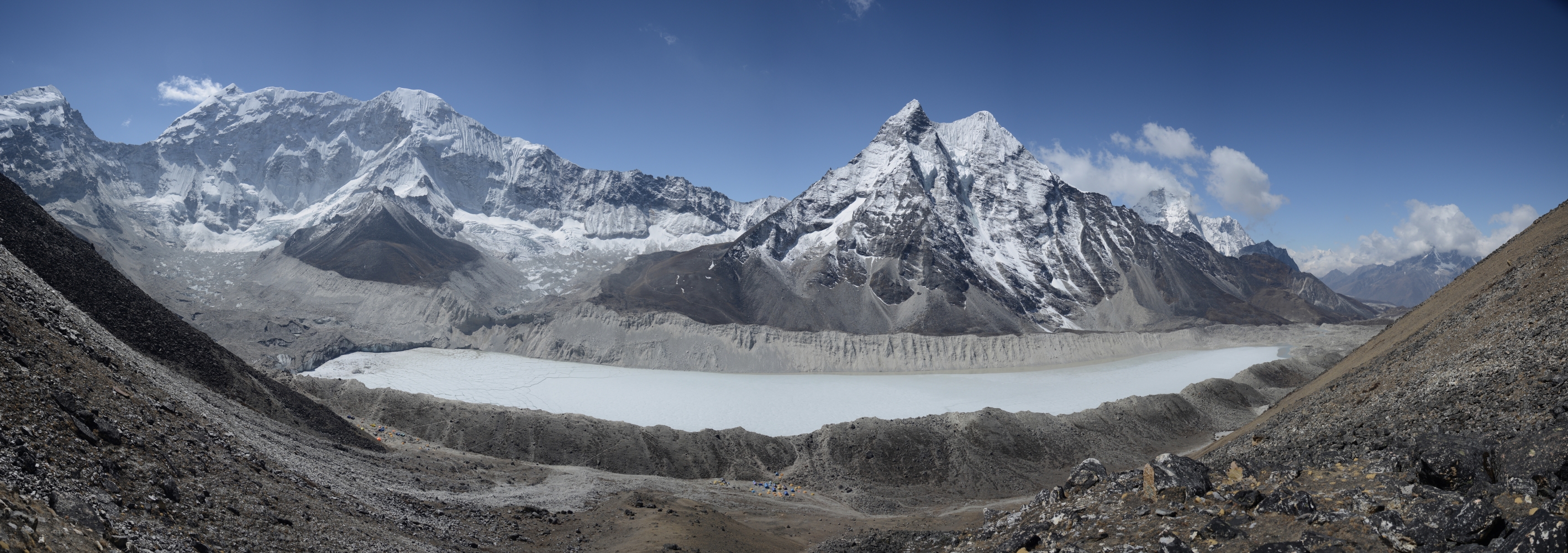
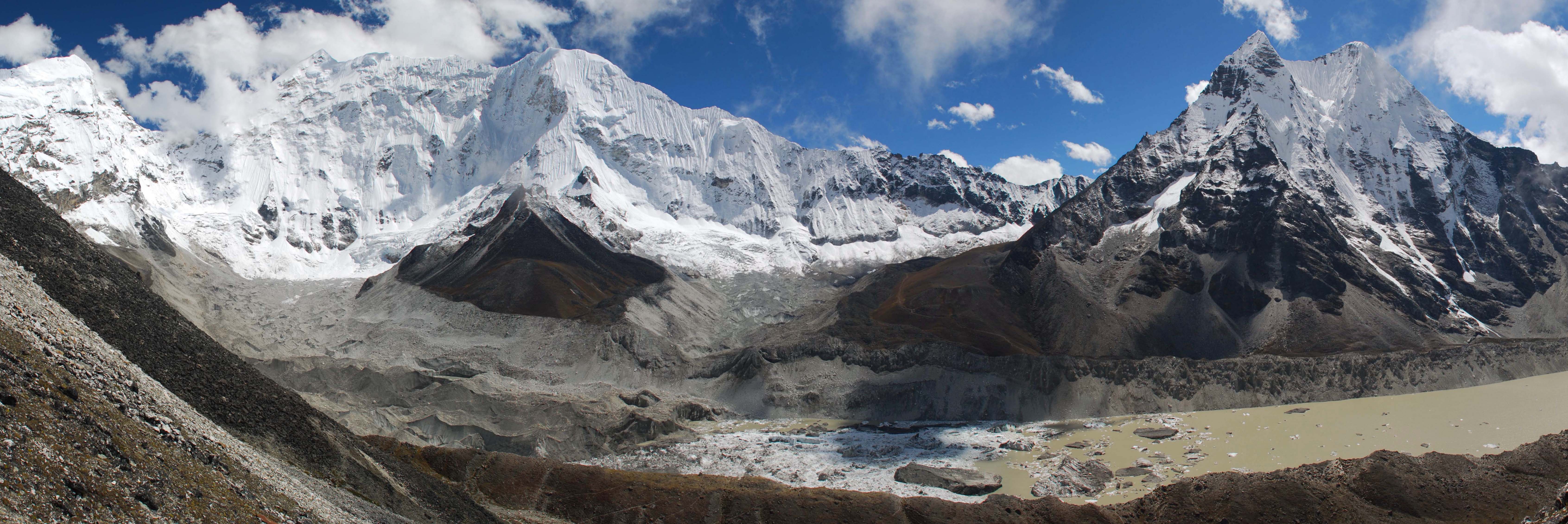
The loss of the region’s snow, ice, and glaciers is particularly sobering, captured by the repeat photograph of cartographer Erwin Schneider’s 1956 image of a debris-covered glacier, which has now turned into a glacial lake containing some 91 million cubic meters of water.
Many good things have resulted from tourism and the modernisation of Khumbu, several of the consequences remain chronically troubling. Thousands of tons of plastic, aluminum, electronic, medical waste continue to be burned and buried each year in the hundreds of landfills that now pockmark the region, poisoning the air, water, people, and animals that live there.
In spite of nearly 200 years of mountaineering history throughout the world, strategies to effectively manage human waste at high altitudes continue to elude the mountaineer and development practitioner alike. Khumbu Since 1950 is thus a reminder that, in spite of much progress, much work remains to ensure a thorough collaboration between the local mountain people and visiting supporters toward sustainable mountain development.
Khumbu Since 1950 is a vital visual tool that will be appreciated and used by visitors, scholars, government, and development workers alike for years to come. The fact that it can now be updated by future Nepali scholars interested in the positive and negative aspects of change over time makes the book all the more valuable.
Jack D Ives is with the Department of Geography and Environmental Studies, Carleton University Ottawa, Canada. JackIves@Cunet.Carleton.ca