
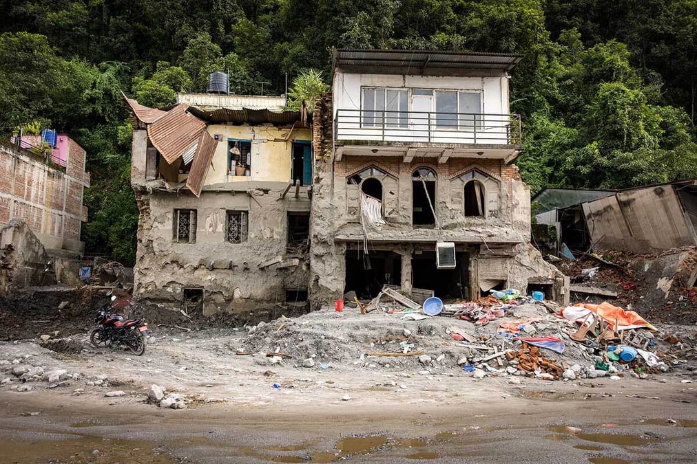
Himalayan countries, climate scientists and experts from across the Himalayan region have pledged to work on 10 priority areas to upgrade disaster preparedness, early warning systems and emergency response and recovery.
Known as the Kathmandu 10 Action Points, the recommendations were made in a meeting in Kathmandu following the catastrophic Rasuwa-Gyirong flood on 26 August. The meeting was convened by the Kathmandu-based International Centre for Integrated Mountain Development (ICIMOD).
Nepal’s National Disaster Risk Reduction and Management Authority (NDRRMA) which co-organised the meeting has reported that more than 1,400 people lost their lives, and approximately 6,000 remain unaccounted for. About 600 of those unaccounted for are nationals from 38 countries. Nepal has suffered economic losses exceeding $5 billion, equivalent to 15% of its GDP.
“We have had a number of wake-up calls, with the region seeing back-to-back mega-hazards. This is a slap in the face and time is running out,” said Pema Gyamtsho, Director General of ICIMOD. “A strengthened regional mechanism to help reduce future risks requires collaboration across countries, disciplines and institutions.”
In his address to the United Nations General Assembly on Thursday, Prime Minister Balendra Shah called for Nepal, India and China to work together to set up a trans-Himalayan early warning and response system for climate-induced disasters.
“We support the Government of Nepal and ICIMOD in learning from the catastrophic Rasuwa-Gyirong flood and in identifying solutions to strengthen detection, monitoring and early warning systems for future ice-rock avalanches and related hazards across the Hindu Kush Himalaya,” said Danielle Meuwly, Ambassador of Switzerland, which also supported the Kathmandu conference.
ICIMOD already groups eight countries in the Himalaya —including Afghanistan, Bangladesh, Bhutan, China, India, Burma, Nepal and Pakistan — and is the only multilateral science and research organisation working in the Himalaya, a region that is not just a climate hotspot but also a geopolitical one.
The Kathmandu 10 Action Points call for stronger regional cooperation, enhanced monitoring of high-risk mountain areas, faster information sharing, improved early warning systems, and more coordinated recovery planning to address growing risks posed by cascading mountain hazards.
The ice-rock avalanche that broke off Mt Langtang Lirung on 26 August was so huge and travelled within minutes to the China-Nepal border and raced downstream into the Trisuli Basin in Nepal, giving little time to warn downstream communities.
“This is not Nepal’s crisis, this is the world’s crisis. The UK’s support would focus on cascading mountain hazards, early warning systems and the hydropower sector - large parts of the Nepali economy may have to be rethought in the light of this disaster,” said Rob Fenn, Ambassador of UK to Nepal.
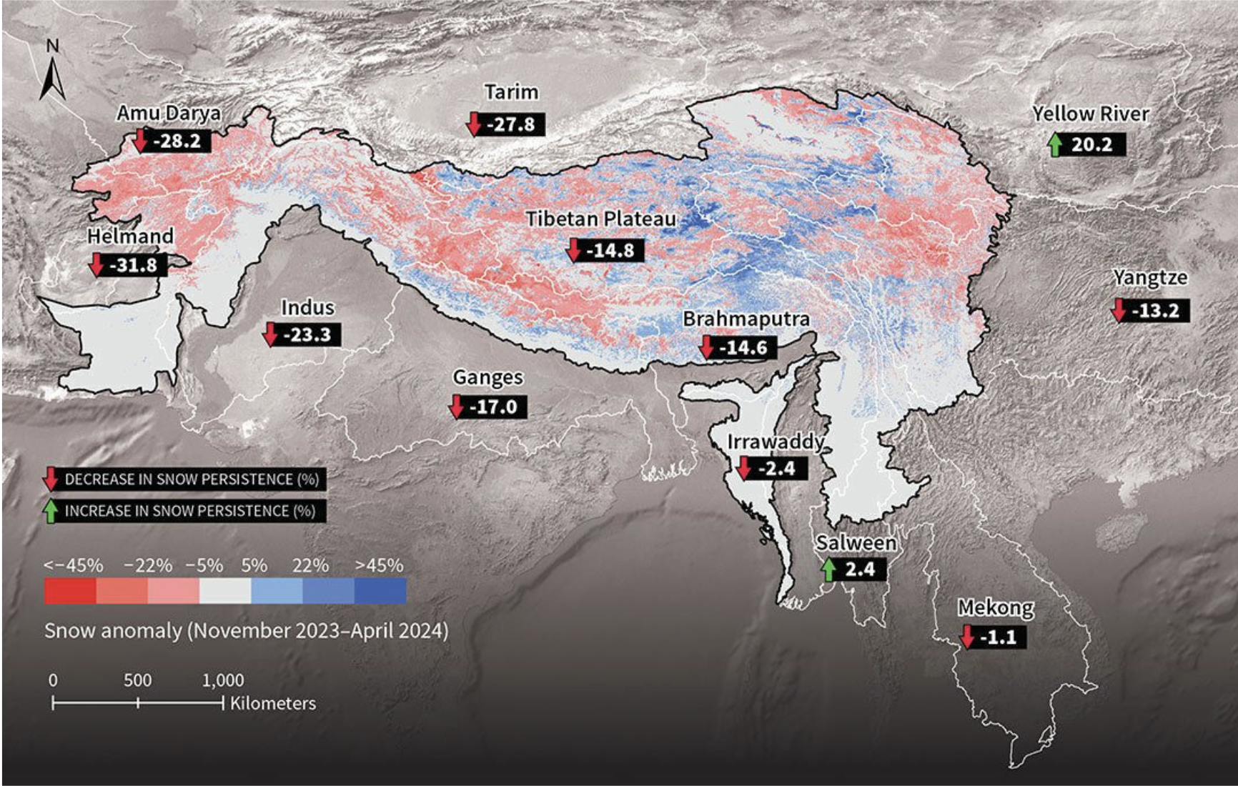
The recommendations reflect growing concern that mountain hazards are becoming more complex, more interconnected and more difficult to manage through traditional risk management approaches. The 26 August Rasuwa-Gyirong flood demonstrated how hazards originating high in the mountains can trigger cascading impacts across river systems, infrastructure, communities and international borders.
Rapid assessment shows that slope failure on Langtang Lirung triggered an ice-rock avalanche that flowed through the Lhende Khola and the Bhote Kosi-Trishuli river system, carrying rock, ice, water, debris, and sediment downstream.
The disaster highlighted the need for greater investment not only in monitoring, but also in risk assessment and data collection. The 10 ACtions call for stronger monitoring of high-risk mountain hotspots, improved cross-border contacts, more effective multi-hazard early warning systems, and better integration of cascading risks into infrastructure planning and development.
The Kathmandu 10 Action Points include:
1 Redesign early warning triggers to account for sudden-onset hazards and improve lead times for communities. Explore the concept of sacrificial infrastructure designed to absorb the impacts of cascading hazards.
2 Create an inventory of multi-hazard hotspots using satellite-based monitoring and impact-based forecasting.
3 Shift transboundary cooperation from sharing raw data to providing decision-ready information, shortening the time between detection and action.
4 Assess regional resources and disaster response capacities through a regional baseline assessment across ICIMOD's Regional Member Countries (RMCs).
5 Review communication and outreach protocols across RMCs and identify mechanisms that can accelerate information sharing during disaster events.
6 Establish a technical working group by leveraging expertise across RMCs and organisations such as ICIMOD, the Asian Disaster Preparedness Centre (ADPC) and the Coalition for Disaster Resilient Infrastructure (CDRI).
7 Create a regional response fund with support from member countries and development partners.
8 Develop a shared data portal to reduce institutional data silos and improve coordination through consolidated cross-agency information.
9 Promote people-centred recovery informed by gender-disaggregated data to support decisions on resettlement, livelihoods, and economic and cultural recovery.
10 Develop phased recovery plans supported by short-, medium- and long-term financing for relief, rehabilitation and risk-informed reconstruction.