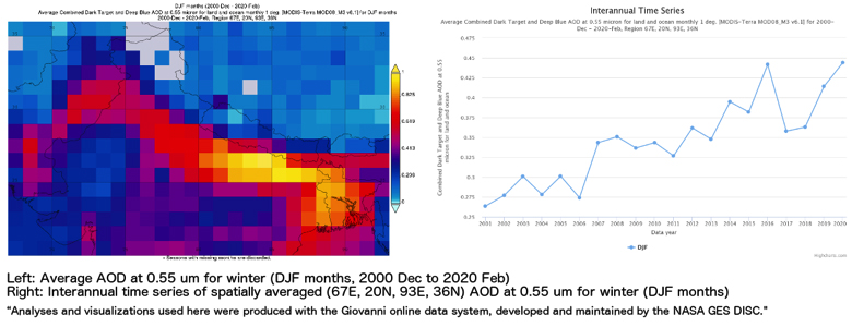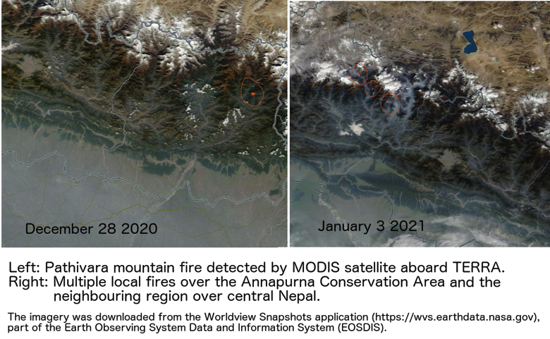
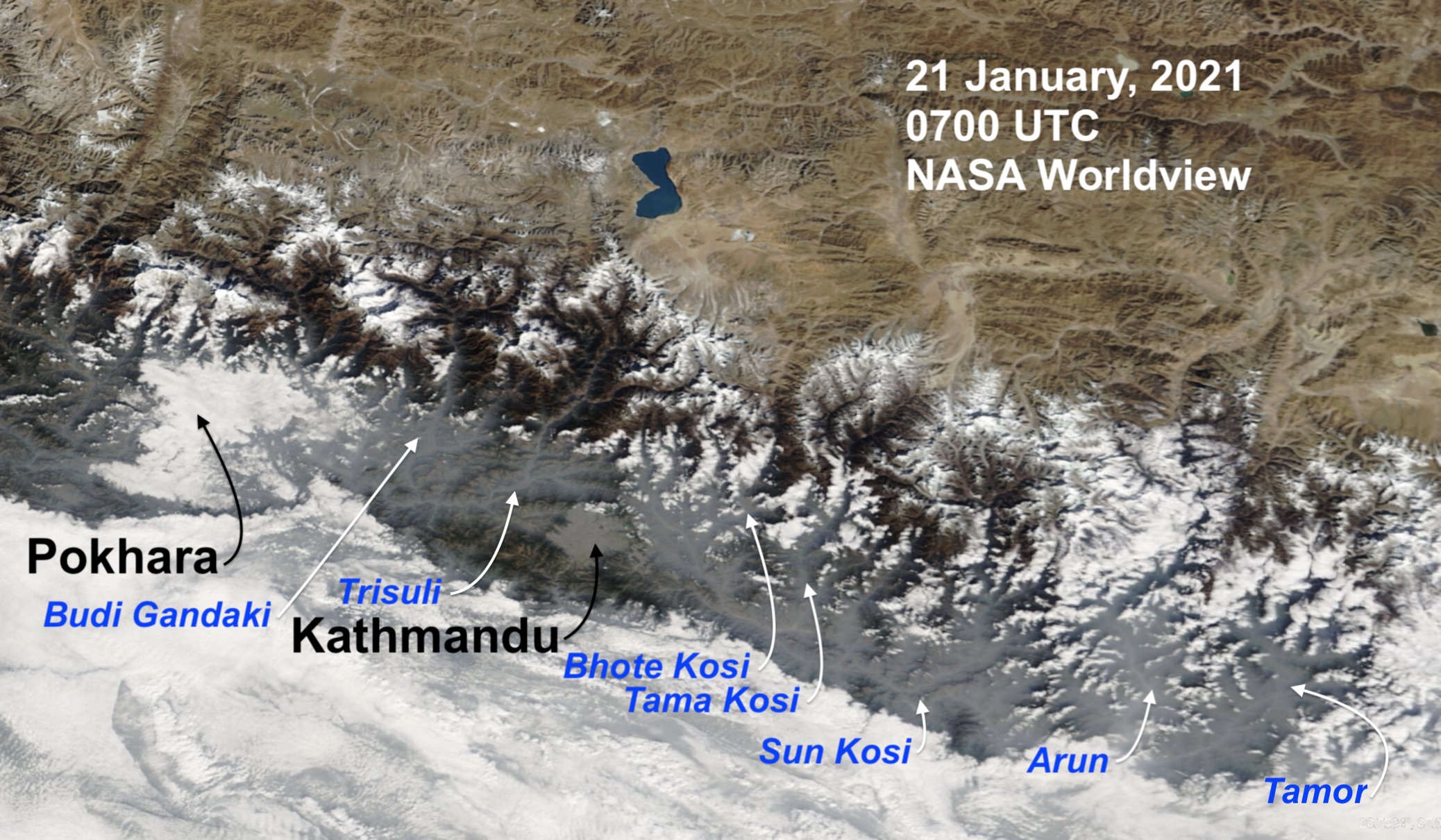
The Himalayan mountains act as a barrier separating the clean air of the Tibetan Plateau from the polluted Indo-Gangetic plains. But Nepal’s rivers cut through the mountains, and their valleys allow smog from the plains to penetrate deep into the mountains.
This haze intrusion goes up to elevations of 4,000m, and the pollution layer is more shallow and flat in winter, and inclined and parallel to the ridgeline in the pre-monsoon. The depth of this pollution layer up the valleys also decreases with elevation.
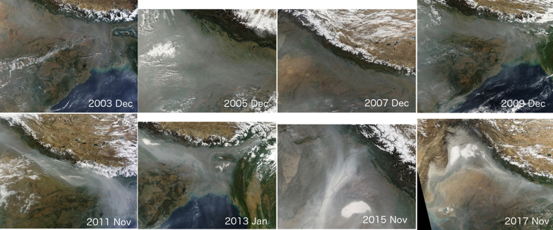
These visible air pollution images are captured regularly by the MODIS (Moderate Resolution Imaging Spectroradiometer) instrument aboard the two NASA satellites Terra and Aqua orbiting the Earth. The dull bluish haze is mostly made up of fine aerosol particles and extends right across the Indo-Gangetic plains from Pakistan to Bangladesh, as well as the Tarai in Nepal.
While human-generated emissions from agricultural burning, urban, rural and industrial emissions are mainly responsible for this region-wide pollution, weather conditions and the blocking effect of the Siwalik Range also affect its spread. More interestingly, if we zoom in on the images, we can see that the haze does not just stay in the plains, but flows up into the inner Himalaya along river valleys.
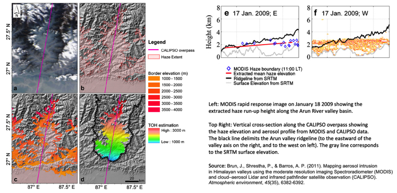
These satellite images provide valuable insight for researchers looking into the geographical spread and long-range transport of aerosol particles. Scientists at Duke University in the United States have developed a novel technique to use the high-resolution satellite images from MODIS and elevation data from SRTM (Shuttle Radar Topography Mission) to extract the daytime haze run-up that measure intrusion length and height over the Arun Valley in eastern Nepal.
The Arun River starts in Tibet, snakes around Mt Everest to find a gap between Makalu and Kangchenjunga to tumble down Himalayan gorges to meet up with the Sun Kosi and Tamor— flowing out into the Tarai at Chhatra and then through the Kosi Barrage to meet the Ganges in India. This also opens up the entry gate for haze to flow from the Indo-Gangetic Plains into the inner Himalayas.
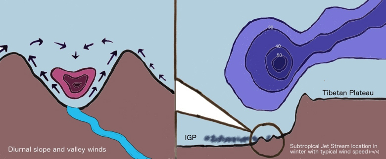
In winter, the surface temperature in the plains plummets, and the air is dry. The southern edge of the Tibetan Plateau at upper levels is also battered by the sub-tropical jetstream, with weak westerly wind below it. The low surface temperature in the plains confines the pollution to a shallow boundary layer that is lower than the Siwalik Range. Up-valley winds along the river valleys then transport the haze into the Inner Himalaya.
The river valley-plains temperature contrast produces a pressure gradient that drives this flow up the valley during the day and down the valley during the night. Besides, the topography, vegetation cover and groundwater level in the slopes can also contribute to warming of valley air which could further amplify the up-valley wind.
In addition, the daytime up-slope and night-time down-slope winds developing in the river valleys also play and important role in ventilating the air pollution from the valley surface.
Measurements of the nature and size of fine aerosols were conducted for the first time in the middle Himalayan region in the pre-monsoon. In general, the aerosol size distribution peaks around 100nm, which is usually the oldest, most processed background aerosol and about the size of the Covid-19 virus.
Another smaller peak around 20 nm, is indicative of fresh but not necessarily local aerosols. The chemical composition of PM2.5 (particulate matter below 2.5 microns) is dominated by organic matter. Organic carbon (OC) comprises the major fraction (64–68%) of the aerosol concentration followed by ionic species (24–26%), Elemental Carbon (EC) compromises 7–10% of the total composition and 27% of OC is water soluble.