
Nepali Times spoke to Director General Kamal Ram Joshi of Department of Hydrology and Meteorology (DHM) about weather extremes and changing rainfall patterns. Excerpts:
Nepali Times: Is the risk of glacial lakes bursting as serious as it is made out to be?
Kamal Ram Joshi: Analysing meteorological data of the past 30 years we see that average temperatures in Nepal are rising at o.o56 Celsius per year. That may not seem like a lot, but it adds up over the decades. More worryingly, the rise in average temperature is much higher: 0.086 Celsius a year. The Himalaya is therefore more at risk from global warming.
This means 24% of our glaciers retreated between 1977 to 2010, and in many of them glacial lakes are expanding. Of total 47 glacial lakes categorised as potentially dangerous for Nepal, 21 are in Nepal, 25 in China and one in India. Since many of our rivers start in China, the impact of glacial lake outburst floods (GLOFs) is transboundary.
In the past 60 years 27 major GLOFs have been recorded in Nepal. Of them, 15 were from lakes in Nepal and 12 originated from Tibet. Lately, we have seen that even smaller unnoticed supra-glacial lakes have turned out to be a serious threat downstream – for example, recent floods in Thame of Khumbu, Namkha of Humla and Bhote Kosi in Rasuwa.
So, what can be done to reduce the risk from GLOFs?
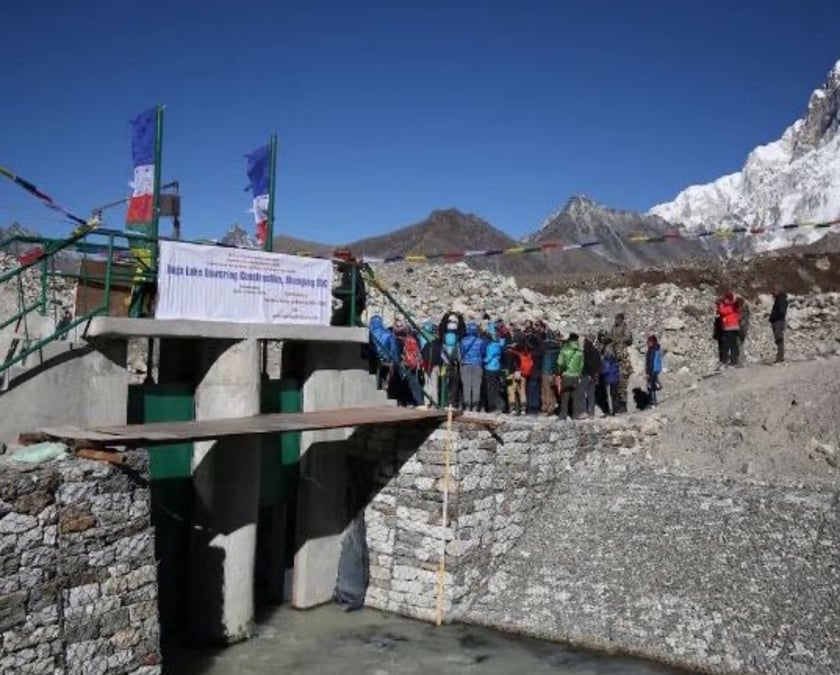
In 2000, with the support of The Netherlands the DHM lowered the level of Tso Rolpa glacial lake by 3.4m. Sixteen years later, we lowered the water level of Imja glacial lake in the Everest region. We have installed automated early warning systems in downstream areas based on precipitation data.
Based on the experience with Imja and Tso Rolpa, we proposed to the Green Climate Fund to reduce the risk of four other dangerous glacial lakes: Thulagi, Hongu 2, Lower Barun and Lumding Tso. It will cost of $50.44, GCF has approved $36.1 million with the UNDP and Nepal government co-financing it.
How easy was it to secure GCF funds?
The Imja lake lowering was with support from the Green Environment Fund, and this experience allowed us to get the GCF on board to lower the water level of four more glacial lakes. We have also prepared a national adaptation plan based on which we can approach other donors and the international community.
Does Nepal graduating from a least developed country affect access to more funds for climate adaptation?
Despite being a climate vulnerable country, Nepal has made good progress especially in the mitigating glacial lake outburst floods. India, Bhutan and China have not lowered their glacial lakes yet. Nepal has a lot of experience that it can share, for example 20 years ago we started an SMS early warning service to save lives from floods. Others can also follow our model. Lowering glacial lakes in Nepal means less risk for downstream countries.
Irrespective of financial and human resources that we have and our topography Nepal has done quite an impressive job in the field of disaster management. We have much more to do making our infrastructure more climate resilient. But we have done our best to disseminate information to save lives.
For example, in August a glacial flood started in China at 3am. If we had been warned, the nine lives we lost on the Bhote Kosi could have been saved. The flood arrived at Rasuwagadi at 6am, and we immediately warned settlements downstream saving lives. So, data sharing is important especially to prevent transboundary disasters. If China doesn’t share data with us, we will not know there is a flood coming.
Neither our northern nor southern neighbours are generous about sharing meteorological data. In Nepal, we share real time data on our official website. It is in the public domain and more people outside Nepal access them than Nepalis. Why? For any flood that originated in Nepal it takes three days to reach India, three more days to reach Bangladesh. We are sharing data on humanitarian grounds, but it is not reciprocal.
How do you plan to lower the remaining four glacial lakes?
We have started an implementation plan defining roles and responsibilities of implementing agencies, finalising project designs, total cost and structures. Based on that, selected firms will lower glacial lake levels and we will install early warning awareness and hydrometric stations. The core objective of this approach is to ensure an end-to-end early warning system and last mile communication. Next, we also protect watersheds after lowering water levels.
What is in Nepal’s national adaptation plan?
Access to global climate finance is evidence-based. No donor will give money without data justifying your claim. Our experience with Tso Rolpa and Imja is proof to potential donors that we have experience and evidence to back it up. At Cop27, we had pledged to ensure early warning for all by 2027, we have now extended that to 2030.
For that, we will expand our forecasting and early warning so that the death and destruction following the tornado in Bara and cloud burst in Manang in 2022 could be prevented. Manang saw 300mm of rain in Manang in June when the average rainfall for that month is 42. The Melamchi flood in 2021 is taken as a disaster of multi-hazard cascade effects.
Last year, an unprecedented 624mm was recorded in Kanchanpur. Because of timely information and rescue, there was zero casualty. But this year 97 people died in flood whereas 34 died in Kathmandu valley despite timely information. That was because of the public ignoring the warnings. It is worth noting that more than 1300 people had died when a similar rainfall volume was recorded in 1993.
Timely information about extreme weather caused by climate breakdown can save lives.