
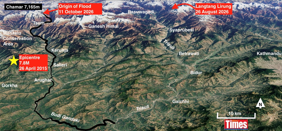
Even as Nepal tries to cope with the enormous flood catastrophe on the Trisuli Valley six weeks ago, another massive debris flow devastated the adjacent Budi Gandaki Valley in the early hours of 11 October.
Phone alerts from the residents of Tsum Valley upstream, from the government’s disaster prevention agency, as well as the fact that the river ominously stopped flowing, gave people down the valley enough time to heed the warning and climb slopes for safety just before dawn on Sunday. The memory of the recent Trisuli flood appears to have convinced many not to take the alerts lightly.
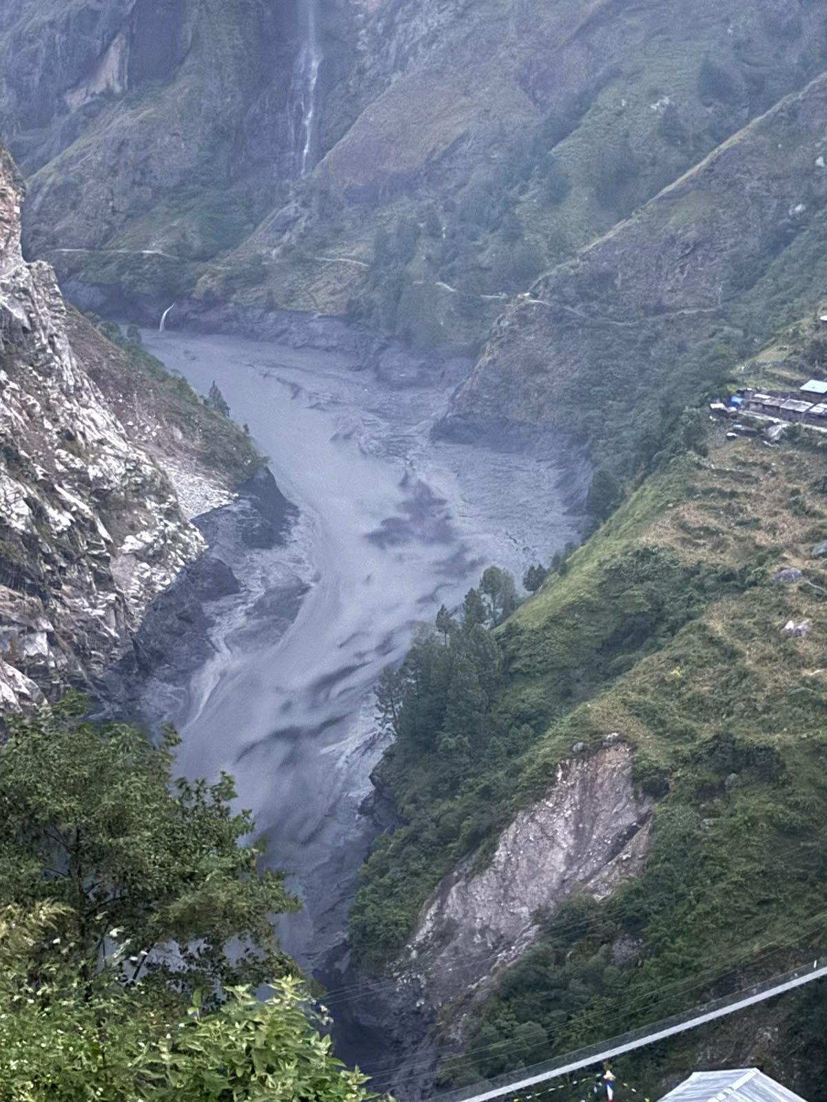
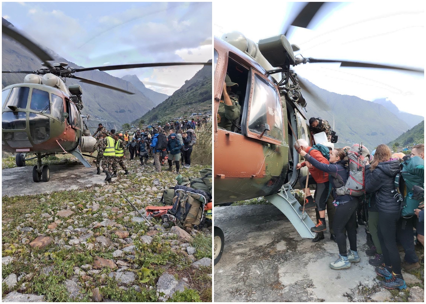
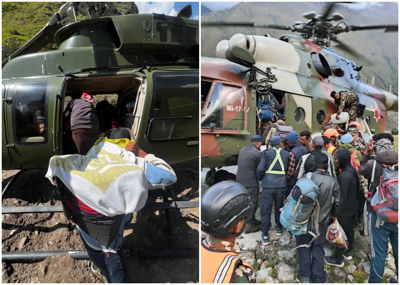
About 10 yak and sheep herders in Tsum Valley directly below the mountain are said to be missing, while further downstream, highway and trail bridges as well sections of the Manaslu circuit were swept away. All Nepali and foreign trekking teams and their guides on the trail are said to be safe because of the timely warning.
The Trisuli disaster itself happened exactly a year after a deadly glacial flood on the same river, and following similar debris flows on the Melamchi and other rivers in recent years. Experts warn that climate breakdown and geological factors may trigger more frequent disasters across the Himalaya in future.
“Coming so soon after the Guirong-Rasuwa disaster of 26 August, Sunday’s event is another reminder of how exposed mountain communities and river corridors remain to sudden, cascading disasters,” said Pema Gyamtsho, Director General of the Kathmandu-based International Centre for Integrated Mountain Development (ICIMOD).
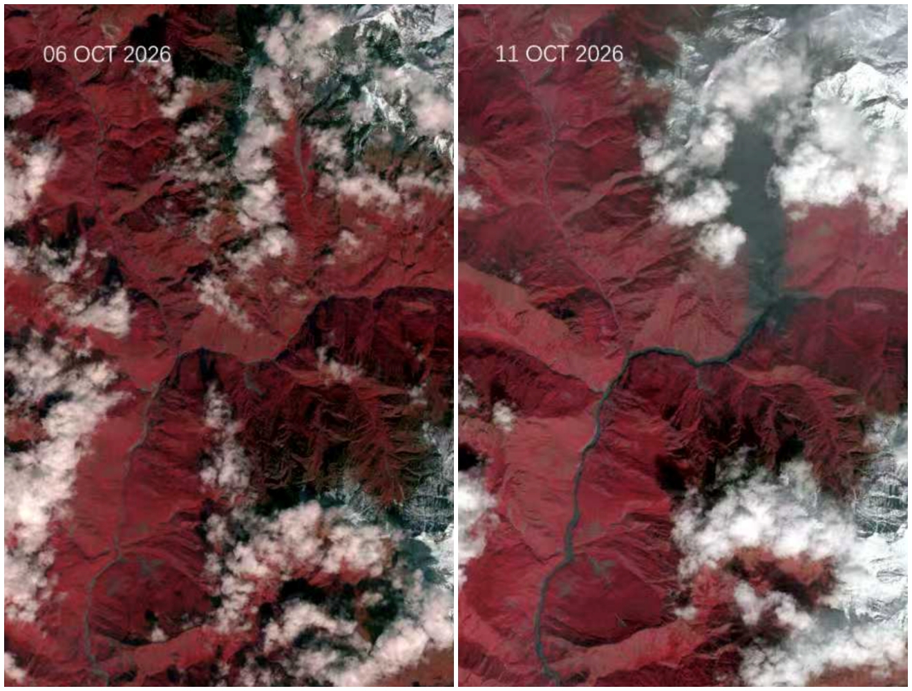
Sunday morning’s flood was puzzling because there had been no heavy precipitation in the Budi Gandaki catchment area over the weekend, even though Central Nepal saw massive blizzards and rainfall earlier this month that deposited more than 3m of snow. Mountaineering expeditions on nearby Mt Manaslu (8,091m) were abandoned because of avalanche danger and after four climbers were killed.
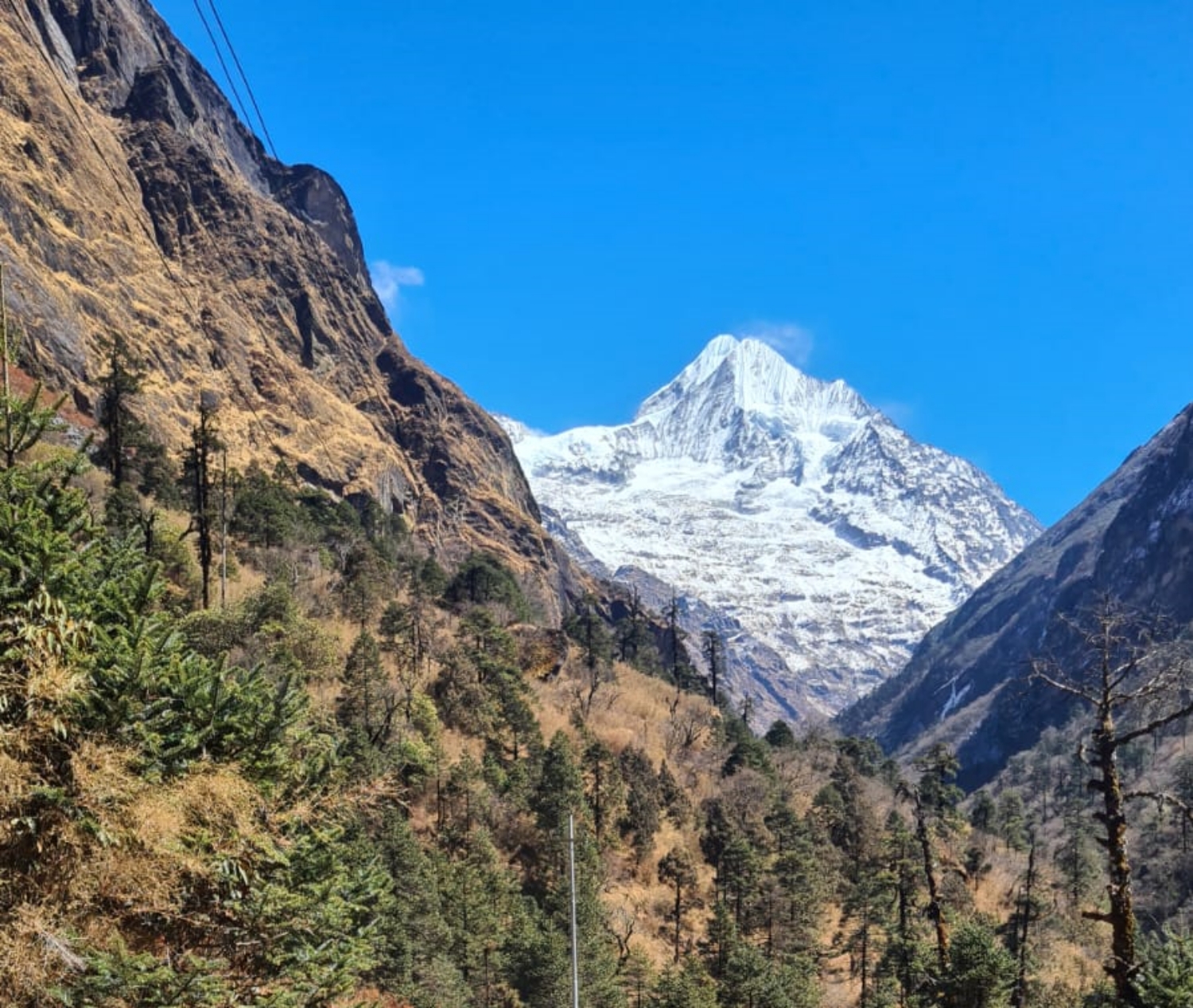
The 11 October flood appears to have been triggered by heavy snow deposition, global warming, and the long-term effect of the 7.8M earthquake in 2015 which was epicentered only 10km to the southwest. This probably led a rock face or glacier, or both, on the east face of Mt Chamar (7,165m) to collapse.
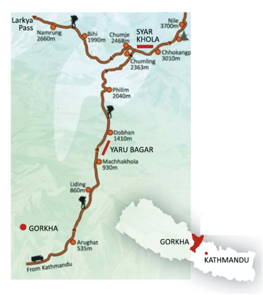
Mt Chamar is the highest peak in the Sringi Himal massif. The debris flow rushed down the Ungilung Khola to reach Dumje where it blocked the Syar Khola that drains the north face of Ganesh Himal in the Tsum Valley.
The Syar joins the Budi Gandaki at Nyak, the village from where the trekking trails to Manaslu Base Camp and Larke Pass diverge from the path to the Tsum Valley Trail. The Budi Gandaki had seen a smaller flood event in April 2024 when a chunk of Manaslu Glacier plunged into the Birendra Glacial Lake and caused it to overflow into the Budi Gandaki.
From photographs and videos taken by residents, there is scouring and dark scars on the sides of the Budi Gandki gorge, indicating that there had been recent flooding on the river. One hypothesis is that the original ice-rock collapse unleashed the first flood at night, then dammed the Syar River which subsequently burst on early Saturday morning (map, featured).
The difference with the Trisuli Valley flood is the lower human casualty, and the reason for that could be that the hyper-concentrated slurry flood moved down the Budi Gandaki at a lower velocity than the one on the Trisuli, which had a higher water content. Even so, the flow of thick black mud had enough momentum to roll down boulders the size of houses up to 40 km downstream to Soti, where a steel highway bridge was swept away.
“While response efforts must remain the immediate priority, understanding what triggered this flood will be critical for reducing future risks and strengthening resilience,” ICIMOD’s Gyamtsho added.
A cantilever path on the gorge above Yaru that was built after the 2015 earthquake destroyed the trail, was also taken away. The Chhote Khola and Budi Gandaki Hydroelectric Project sustained damage. The Budi Gandaki corridor is less densely populated and is not a major economic and trade corridor like the Trisuli, although it is on the Manaslu trekking circuit.
A massive 270m-high dam with a reservoir to generate 1,200MW of electricity is planned near the point where the Budi Gandaki meets the Trisuli River at Benighat. It would submerge the valley up to 40km upstream. But successive contracts to design and build it have been awarded and scrapped by various coalition governments in the past 30 years. The sediment load of this flood would have partially filled the lake if the reservoir had already been built.
The Sringi Himal massif rises nearly 5,500m from the valley floor at the confluence of the Syar and Budi Gandaki gorges which is at only 2,000m elevation. The bedrock or glacier that collapsed on the east face of the Sringi massif is located at 5,500m, and videos show the debris flow up to 200m high below Chumling village.
A video clip by local residents at Dobhan above the Budi Gandaki shows that the river had stopped flowing before the wall of black sludge arrived. Other clips show police posts, hydropower project quarters, trail bridges roads being swept away in seconds.
Sunday morning’s flood has also exposed a gap in the government’s Flood Forecasting Division alert system, and slow National Disaster Risk Reduction and Management Authority (NDRRMA) response with early-enough warnings. There are no functioning remote sensing equipment in the upper reaches of most rivers below glaciers and glacial lakes, and by the time flood detectors downstream sound the alarm it is usually too late. In the Trisuli in August, flood detectors that transmitted alerts every 10 minutes were destroyed by the first surge of the debris flow.
“Current analysis points to the possible failure of a temporary landslide blockage that released a heavily sediment-laden flood downstream,” said climate risk analyst Qianggong Zhang at ICIMOD. “Events like this demonstrate why monitoring and evaluating unstable slopes and river systems together is essential in steep mountain catchments, where hazards can develop rapidly and affect communities far downstream.”
What saved lives on Sunday were communities along the Budi Gandaki Valley alerting each other about the approaching flood as well as the slower speed at which the slurry flood moved.
The Tsum Valley is one of the sacred valleys long the Himalaya called ‘beyul’ — remote sites of exceptional natural beauty where monks and others seeking refuge from persecution used to live in for safety. Tsum is also where the Tibetan sage Milarepa meditated in a cave, and Padsambhava Guru Rimpoche travelled to in the 8th century CE to preach non-violence and inspired the Tsum Valley’s monasteries and nunneries like Mu, Lungdang and Rachen.