
Alton Byers has organised frequent research expeditions to the Himalaya for more than 50 years. Recently, he returned to the Kanchenjunga region which he has visited three times since 2019.
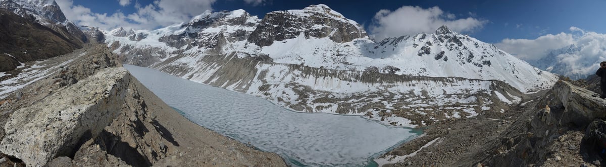
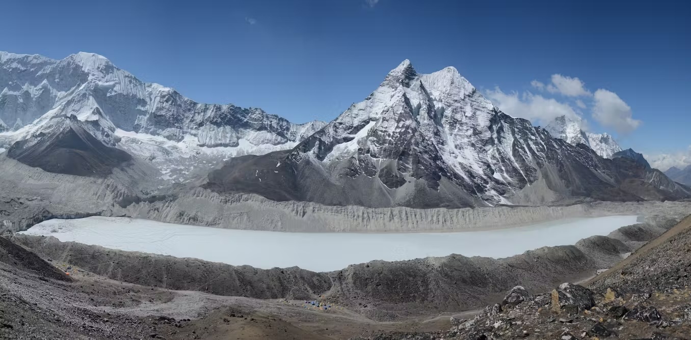
His team was there to gather more data for an ongoing study of glacial, ecological and socioeconomic changes in the region. But, his attention was soon diverted when a young man from the local community told Byers that locals had noticed large meltwater ponds forming at the toe of the Kanchenjunga Glacier, upstream from Ghunsa and Kambachen.
“He asked if we could go take a look at it,” Byers said. “We were on our way up to the Kanchenjunga base camp, so we made a detour. Sure enough, you could see these considerable lakes, perhaps a half-a-square-mile and growing.”
Byers sprung into action. First, he interviewed other community members about the ponds — they confirmed the observations and growing concern. Then, over the ensuing months, he assembled a team of experts to conduct a study of how the ponds were changing. The study was published in the journal Water earlier this month.
The paper outlines a number of potentially dangerous flood scenarios that could be triggered at the site in the future. The researchers urge regional authorities to implement mitigation measures, including a monitoring program and an early warning system for flooding.
Byers’ first call for collaboration was to Sonam Wangchuk, an expert in snow and ice research via satellite imagery at the International Centre for Integrated Mountain Development.
The images were striking. From 2022 to 2024, the ponds grew from puddles to large, interconnected bodies of water.
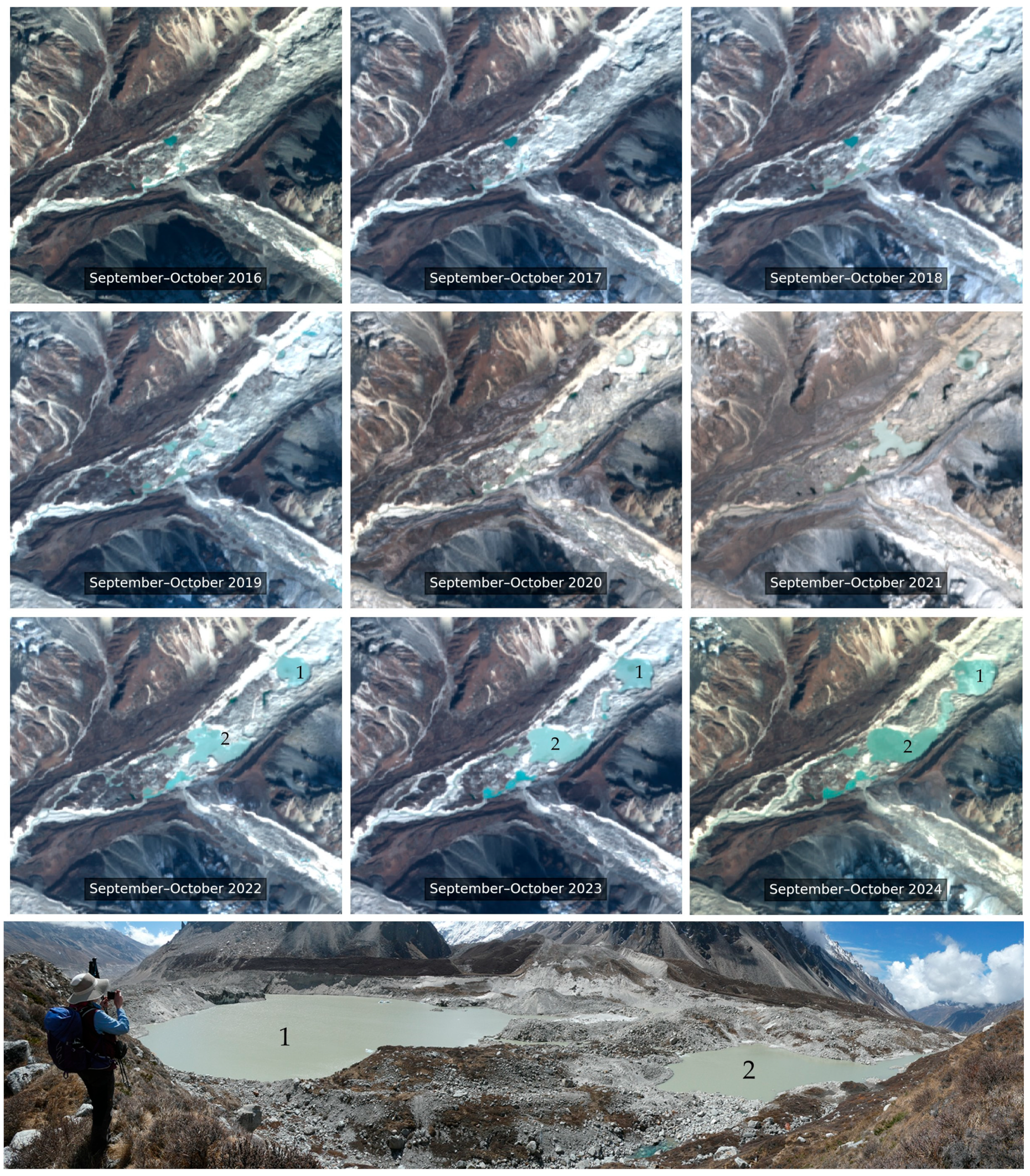
“It’s sort of an indicator of how these melting processes are accelerating,” Byers said.
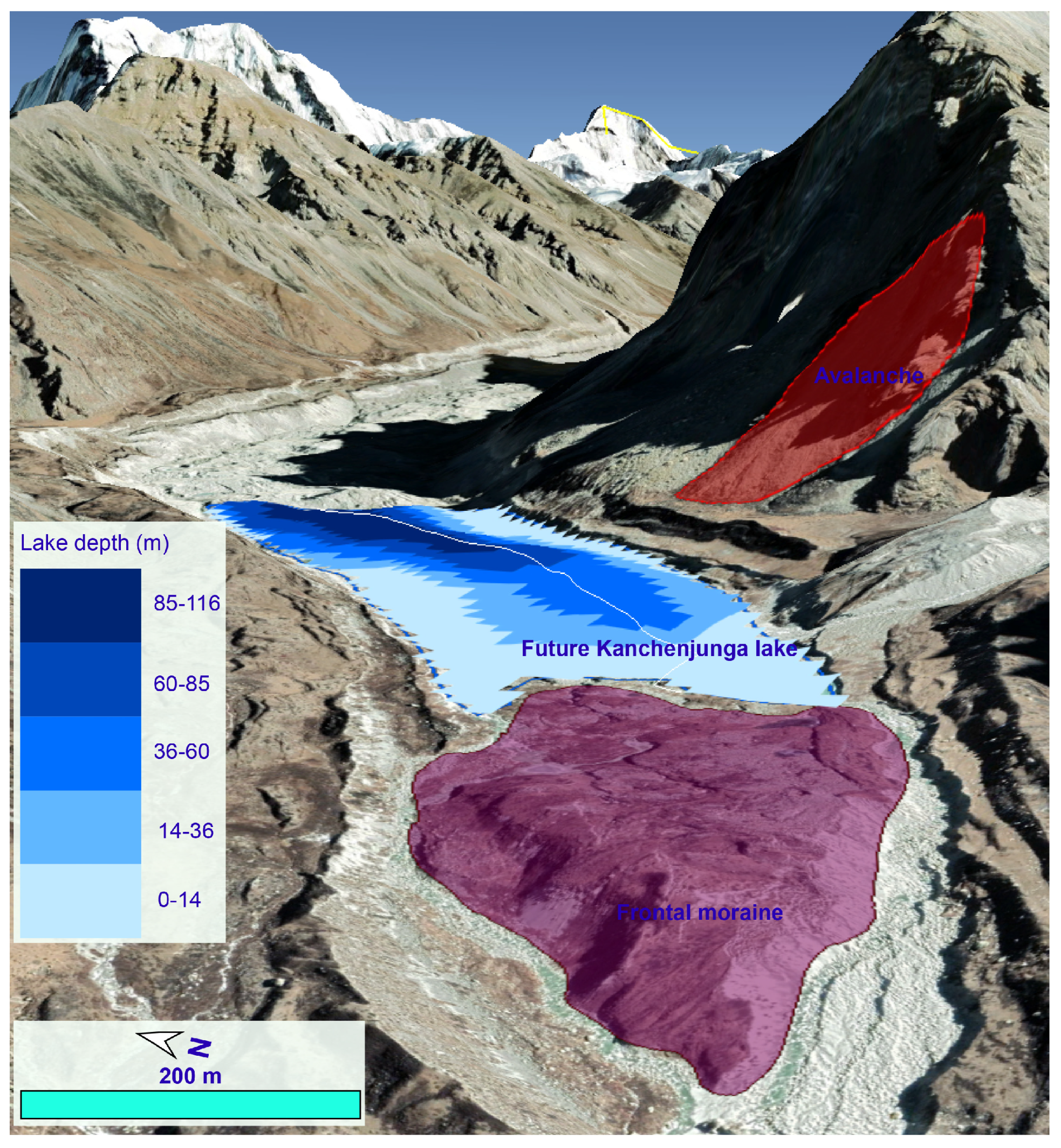
Next, Byers and collaborators estimated that the meltwater ponds could form a large glacial lake. That lake, if it forms, will be vulnerable to outburst flooding, which could be triggered by melting processes, structural collapse or rockfall from surrounding slopes.
Finally, the researchers focused their efforts on modeling potential floods. They identified four scenarios, from small to large.
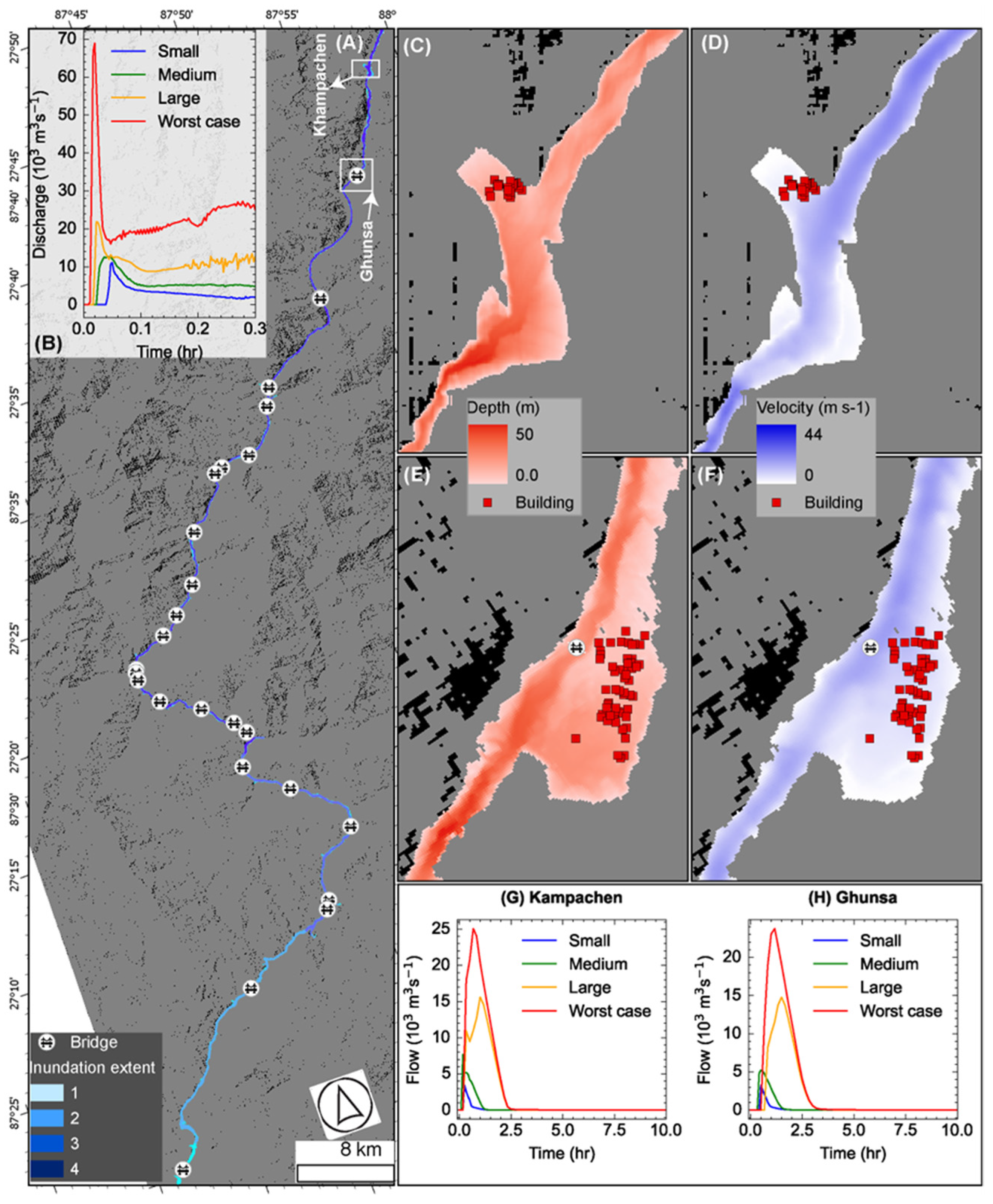
Under the mildest scenario, the flood surge would travel 100km down the Tamor River, and under the worst-case scenario it would travel at least 220km with impact on houses and bridges, livestock, crops and tourism infrastructure.
Byers warns that without adequate preparation, glacial outburst flooding can be deadly. The paper advises local and regional authorities to take measures to prevent a flood originating from the study site. Their recommendations include establishing early warning systems for flooding, partnering with research organisations in Kathmandu to monitor the site and adapting zoning laws to prevent new buildings in flood zones.
Read also: The not-so-permanent frost, Wilfried Haeberli and C Alton Byers
One of the cheapest and most effective early warning systems is deceptively simple: cell phones. Says Byers: “Not everyone can afford multi-million dollar early warning systems that rely on laser readings of water depth. But, studies have shown that cell phones, at least during the daytime, are one of the better early warning systems out there.”
Byers hopes the study can help the same people that brought the issue to his attention: “The goal was always to share the research with the local community. Then they have all of the information they need to make the best decisions possible.”
Gabe Allen is Senior communications specialist at the Institute of Arctic and Alpine Research at the University of Colorado Boulder.